|
search place name
|
||
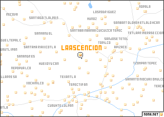
La Ascención (Tlaxcala, Mexico)La Ascención is a town in the Tlaxcala region of Mexico. An overview map of the region around La Ascención is displayed below.
regional and 3d topo map of La Ascención, Mexico ::
La Ascención airports ::
The nearest airport is TXA - Tlaxcala, located 16.1 km north of La Ascención.
Other airports nearby include PBC - Puebla Hermanos Serdan Intl (30.9 km south west), MEX - Mexico City Licenciado Benito Juarez Intl (88.5 km west), PCA - Pachuca Ingeniero Juan Guillermo Villasana (94.5 km north west), CVJ - Cuernavaca General Mariano Matamoros (125.4 km south west), Nearby towns ::
San Simón Tlatlauhquitepec (1.0km south east) //
San Diego Tenango (2.2km north) //
Las Ascención Huizcolotepec (2.2km south) //
Tlacocalpan (3.5km south) //
San Martín Xaltocan (3.6km north east) //
San Tadeo Huiloapan (3.8km west) //
Tlacuilocan (3.9km east) //
Cuatla (4.7km north) //
Rosario Ocotoxco (5.3km east) //
Topilco (5.5km north east) //
La Reforma (5.9km north west) //
Blanca (5.7km west) //
Texantla (6.0km south west) //
Santa Bárbara Acuicuizcatepec (6.2km north east) //
San Lorenzo Tlacualoyan (6.0km east) //
San Bernabé Amaxac de Guerrero (6.4km south east) //
Santa Marta (6.5km south east) //
San Benito Xaltocan (6.4km east) //
Tepectipan (7.1km south) //
Tepetomatitlán (7.1km south east) //
Pie Chico (7.3km north) //
San Dionisio Yauhquemehcan (6.9km east) //
Quiahuitzlán (7.3km south) //
San Lucas Tecopilco (7.4km north) //
Tlaxcantitla (7.4km north) //
San José Techopa (7.4km north) //
Santa Úrsula Zimatepec (7.2km east) //
Huexoyucan (7.4km west) //
Tecolotla (7.7km south east) //
[all distances 'as the bird flies' and approximate] 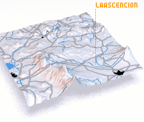 Places with similar names to La Ascención, Mexico ::
// La Asunción (CU)
// La Asunción (CU)
// La Asunción (CU)
// La Asunción (CU)
// La Asunción (CU)
// La Asunción (CR)
// La Asunción (SV)
// La Ascención (MX)
// La Asunción (MX)
// La Asunción (MX)
Disclaimer :: Information on this page comes without warranty of any kind |
||
|
Where is La Ascención? Elevation and coordinates ::
Latitude (lat): 19°24'10"N Longitude (lon): 98°13'50"W
Elevation (approx.): 2544m (map arrows pan, magnifying glasses zoom) |
||
|
Visiting La Ascención? Hotel/Accommodation ::
Book a hotel in La Ascención Travel Guide ::
Buy a travel guide for Mexico rental cars ::
car rental offers GPS waypoint ::
download a GPX waypoint (PoI) of La Ascención for your GPS receiver
|
||