|
search place name
|
||
Santa Úrsula Zimatepec (Tlaxcala, Mexico)Santa Úrsula Zimatepec is a town in the Tlaxcala region of Mexico. An overview map of the region around Santa Úrsula Zimatepec is displayed below.
regional and 3d topo map of Santa Úrsula Zimatepec, Mexico ::

Santa Úrsula Zimatepec airports ::
The nearest airport is TXA - Tlaxcala, located 13.2 km north of Santa Úrsula Zimatepec.
Other airports nearby include PBC - Puebla Hermanos Serdan Intl (36.2 km south west), MEX - Mexico City Licenciado Benito Juarez Intl (95.4 km west), PCA - Pachuca Ingeniero Juan Guillermo Villasana (97.5 km north west), TCN - Tehuacan (128.7 km south east), Nearby towns ::
San Dionisio Yauhquemehcan (0.4km south west) //
Apizaco (1.5km east) //
San José Tetel (1.7km north) //
San Benito Xaltocan (1.8km south) //
Topilco (2.1km west) //
San Lorenzo Tlacualoyan (2.5km south west) //
Santa Ana Huiloac (2.6km south east) //
Cerrito de Guadalupe (3.4km east) //
Tlacuilocan (3.7km south west) //
San Martín Xaltocan (3.8km west) //
Rosario Ocotoxco (4.2km south west) //
Santa Bárbara Acuicuizcatepec (5.1km north west) //
Morelos (5.3km north) //
Santa Marta (5.6km south) //
Apizaquito (5.4km east) //
Santa María Atlihuetzián (5.9km south) //
Cuatla (5.8km north west) //
San Bernabé Amaxac de Guerrero (6.2km south) //
San Francisco Atezcatzinco (6.2km north east) //
Zacatepc (6.5km north) //
Los Álamos (6.5km north west) //
Metecatlán (6.8km south) //
San Simón Tlatlauhquitepec (6.5km west) //
San Diego Tenango (6.9km west) //
Santiago Tetla (6.9km east) //
San Bartolomé Metlalohcan (7.2km north east) //
La Ascención (7.2km west) //
San Isidro Chipila (7.8km north) //
Dolores (7.6km north east) //
[all distances 'as the bird flies' and approximate] 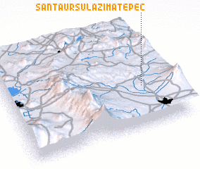 Places with similar names to Santa Úrsula Zimatepec, Mexico :: Disclaimer :: Information on this page comes without warranty of any kind |
||
|
Where is Santa Úrsula Zimatepec? Elevation and coordinates ::
Latitude (lat): 19°25'10"N Longitude (lon): 98°9'50"W
Elevation (approx.): 2432m (map arrows pan, magnifying glasses zoom) |
||
|
Visiting Santa Úrsula Zimatepec? Hotel/Accommodation ::
Book a hotel in Santa Úrsula Zimatepec Travel Guide ::
Buy a travel guide for Mexico rental cars ::
car rental offers GPS waypoint ::
download a GPX waypoint (PoI) of Santa Úrsula Zimatepec for your GPS receiver
|
||