|
search place name
|
||
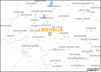
La Estrella (Guanajuato, Mexico)La Estrella is a town in the Guanajuato region of Mexico. An overview map of the region around La Estrella is displayed below.
regional and 3d topo map of La Estrella, Mexico ::
La Estrella airports ::
The nearest airport is ZMM - Zamora, located 52.5 km south west of La Estrella.
Other airports nearby include BJX - Del Bajio Guanajuato Intl (81.7 km north east), UPN - Uruapan Licenciado Y Gen Ignacio Lopez Rayon (110.6 km south), MLM - Morelia General Francisco J Mujica Intl (112.1 km south east), GDL - Guadalajara Don Miguel Hidalgo Y Costilla Intl (144.6 km west), Nearby towns ::
Laguna Larga (1.1km north) //
La Hormiga (1.8km south east) //
Salitrillo (3.4km north east) //
Los Ocotes (3.5km north west) //
Morelos (3.8km south east) //
San Miguel de Camarena (3.9km east) //
Guayabito de Pedroza (4.4km west) //
El Guayabito (4.4km west) //
La Maraña (4.5km east) //
Cal Grande (4.8km south) //
San José de las Moras (4.8km east) //
La Cal Grande (5.2km south) //
Madeja (5.3km north) //
La Cinta (5.3km north west) //
Las Liebres (5.4km west) //
Santo Domingo (6.0km north) //
Jamacua (6.0km north east) //
Arachipo (6.0km east) //
El Rodeo (6.1km north west) //
Churintzillo (6.5km south east) //
La Ermita (6.9km west) //
Buenavista de Cortés (6.9km east) //
Tarengo (7.5km north west) //
San Miguel (7.9km north) //
Santa Ana Pacueco (7.5km west) //
La Carrera (8.0km north east) //
Corrales de Santiago (8.1km south east) //
Chachihuapan (8.5km north west) //
La Piedad Cavadas (8.4km south west) //
[all distances 'as the bird flies' and approximate] 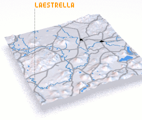 Places with similar names to La Estrella, Mexico ::
// La Estrella (PA)
// La Estrella (PA)
// La Estrella (PA)
// La Estrella (PA)
// Lustrola (IT)
// Lastral (PT)
// La Estrella (CU)
// La Estrella (CU)
// La Estrella (CU)
// La Estrella (CU)
Disclaimer :: Information on this page comes without warranty of any kind |
||
|
Where is La Estrella? Elevation and coordinates ::
Latitude (lat): 20°23'26"N Longitude (lon): 101°55'56"W
Elevation (approx.): 1679m (map arrows pan, magnifying glasses zoom) |
||
|
Visiting La Estrella? Hotel/Accommodation ::
Book a hotel in La Estrella Travel Guide ::
Buy a travel guide for Mexico rental cars ::
car rental offers GPS waypoint ::
download a GPX waypoint (PoI) of La Estrella for your GPS receiver
|
||