|
search place name
|
||
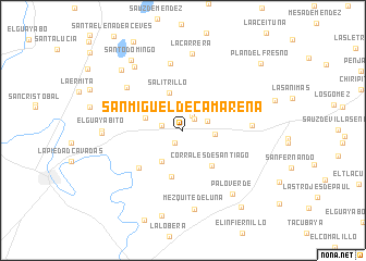
San Miguel de Camarena (Guanajuato, Mexico)San Miguel de Camarena is a town in the Guanajuato region of Mexico. An overview map of the region around San Miguel de Camarena is displayed below.
regional and 3d topo map of San Miguel de Camarena, Mexico ::
San Miguel de Camarena airports ::
The nearest airport is ZMM - Zamora, located 54.1 km south west of San Miguel de Camarena.
Other airports nearby include BJX - Del Bajio Guanajuato Intl (80.7 km north east), MLM - Morelia General Francisco J Mujica Intl (108.3 km south east), UPN - Uruapan Licenciado Y Gen Ignacio Lopez Rayon (109.7 km south), GDL - Guadalajara Don Miguel Hidalgo Y Costilla Intl (148.4 km west), Nearby towns ::
Morelos (1.5km south west) //
San José de las Moras (1.6km north east) //
La Maraña (1.8km north east) //
La Hormiga (2.1km west) //
Arachipo (2.5km east) //
Buenavista de Cortés (3.1km east) //
Cal Grande (3.8km south west) //
La Estrella (3.9km west) //
Salitrillo (4.1km north) //
Laguna Larga (4.5km north west) //
Corrales de Santiago (4.6km south east) //
Churintzillo (4.8km south) //
La Cal Grande (5.7km south west) //
Jamacua (6.9km north) //
Buenos Aires (6.7km east) //
Los Ocotes (7.0km north west) //
La Carrera (7.9km north) //
Mezquite de Luna (8.2km south) //
Madeja (8.1km north west) //
Palo Verde (8.1km south east) //
Guayabito de Pedroza (7.8km west) //
El Guayabito (7.8km west) //
La Cinta (8.5km north west) //
Santo Domingo (8.7km north west) //
Cañada de Ramírez (9.0km south) //
La Estancia (9.0km south) //
San José de Morales (9.6km south east) //
Plan del Fresno (10.2km north east) //
[all distances 'as the bird flies' and approximate] 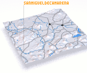 Places with similar names to San Miguel de Camarena, Mexico :: Disclaimer :: Information on this page comes without warranty of any kind |
||
|
Where is San Miguel de Camarena? Elevation and coordinates ::
Latitude (lat): 20°22'43"N Longitude (lon): 101°53'50"W
Elevation (approx.): 1680m (map arrows pan, magnifying glasses zoom) |
||
|
Visiting San Miguel de Camarena? Hotel/Accommodation ::
Book a hotel in San Miguel de Camarena Travel Guide ::
Buy a travel guide for Mexico rental cars ::
car rental offers GPS waypoint ::
download a GPX waypoint (PoI) of San Miguel de Camarena for your GPS receiver
|
||