|
search place name
|
||
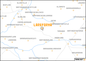
La Reforma (Oaxaca, Mexico)La Reforma is a town in the Oaxaca region of Mexico. An overview map of the region around La Reforma is displayed below.
regional and 3d topo map of La Reforma, Mexico ::
La Reforma airports ::
The nearest airport is TCN - Tehuacan, located 88.6 km north of La Reforma.
Other airports nearby include OAX - Oaxaca Xoxocotlan Intl (128.8 km south east), PBC - Puebla Hermanos Serdan Intl (174.4 km north west), TXA - Tlaxcala (206.8 km north), CVJ - Cuernavaca General Mariano Matamoros (208.0 km north west), Nearby towns ::
Santiago del Río (5.2km south) //
San Francisco El Grande (5.7km north) //
Xatán (5.5km north east) //
San Sebastián Tutla (7.4km east) //
San Andrés Dinicuiti (7.6km south west) //
Tandique (7.6km east) //
San Francisco El Chico (8.0km north west) //
Río del Oro (7.8km south east) //
Corral de Piedra (8.2km west) //
San Isidro El Porvenir (9.6km south east) //
San Juan Cuitito (12.2km south west) //
[all distances 'as the bird flies' and approximate] 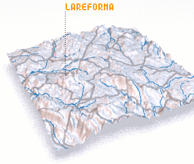 Places with similar names to La Reforma, Mexico ::
// La Reforma (CU)
// La Reforma (CU)
// La Reforma (CU)
// La Reforma (CU)
// La Reforma (US)
// La Reforma (CO)
// La Reforma (CO)
// La Reforma (CO)
// La Reforma (CO)
// La Reforma (CO)
Disclaimer :: Information on this page comes without warranty of any kind |
||
|
Where is La Reforma? Elevation and coordinates ::
Latitude (lat): 17°43'58"N Longitude (lon): 97°40'3"W
Elevation (approx.): 2276m (map arrows pan, magnifying glasses zoom) |
||
|
Visiting La Reforma? Hotel/Accommodation ::
Book a hotel in La Reforma Travel Guide ::
Buy a travel guide for Mexico rental cars ::
car rental offers GPS waypoint ::
download a GPX waypoint (PoI) of La Reforma for your GPS receiver
|
||