|
search place name
|
||
San Isidro El Porvenir (Oaxaca, Mexico)San Isidro El Porvenir is a town in the Oaxaca region of Mexico. An overview map of the region around San Isidro El Porvenir is displayed below.
regional and 3d topo map of San Isidro El Porvenir, Mexico ::

San Isidro El Porvenir airports ::
The nearest airport is TCN - Tehuacan, located 96.1 km north of San Isidro El Porvenir.
Other airports nearby include OAX - Oaxaca Xoxocotlan Intl (120.4 km south east), PBC - Puebla Hermanos Serdan Intl (184.0 km north west), PXM - Puerto Escondido Intl (204.9 km south), TXA - Tlaxcala (216.3 km north), Nearby towns ::
Santiago del Río (4.6km north west) //
Río del Oro (5.5km north east) //
Santo Domingo Yodohino (6.9km south west) //
Tamazulapan del Progreso (7.3km north east) //
Tandique (8.5km north east) //
La Reforma (9.6km north west) //
Magdalena Cañadaltepec (10.8km south east) //
[all distances 'as the bird flies' and approximate] 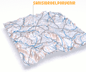 Places with similar names to San Isidro El Porvenir, Mexico :: Disclaimer :: Information on this page comes without warranty of any kind |
||
|
Where is San Isidro El Porvenir? Elevation and coordinates ::
Latitude (lat): 17°39'11"N Longitude (lon): 97°37'55"W
Elevation (approx.): 2160m (map arrows pan, magnifying glasses zoom) |
||
|
Visiting San Isidro El Porvenir? Hotel/Accommodation ::
Book a hotel in San Isidro El Porvenir Travel Guide ::
Buy a travel guide for Mexico rental cars ::
car rental offers GPS waypoint ::
download a GPX waypoint (PoI) of San Isidro El Porvenir for your GPS receiver
|
||