|
search place name
|
||
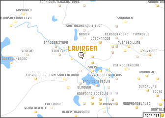
La Virgen (Guanajuato, Mexico)La Virgen is a town in the Guanajuato region of Mexico. An overview map of the region around La Virgen is displayed below.
regional and 3d topo map of La Virgen, Mexico ::
La Virgen airports ::
The nearest airport is QRO - Queretaro Intercontinental, located 68.5 km north of La Virgen.
Other airports nearby include TLC - Toluca Licenciado Adolfo Lopez Mateos Intl (91.2 km south east), MLM - Morelia General Francisco J Mujica Intl (101.5 km west), MEX - Mexico City Licenciado Benito Juarez Intl (122.3 km south east), PCA - Pachuca Ingeniero Juan Guillermo Villasana (134.9 km east), Nearby towns ::
Los Toriles (1.5km north) //
Las Mangas (2.2km east) //
San José los Reyes (2.2km west) //
San José (2.3km east) //
San Antonio (2.8km south) //
Solís (3.4km south east) //
Donicá (4.7km north) //
San Nicolás Solís (4.7km south east) //
Contepec (4.9km west) //
Pueblo Nuevo Solís (5.5km south) //
Los Charcos (5.4km north east) //
La Mesa del Venado (6.1km south west) //
Agostadero (6.0km east) //
Calderas (6.2km south east) //
Santiago Mexquititlán (6.6km north) //
San José Ixtapa (6.4km north west) //
San Vicente Solís (6.7km south east) //
Cerritos de Cárdenas (6.6km south east) //
Santa María la Loma (6.6km east) //
Pozo de las Palomas (7.1km south west) //
El Rodeo (7.4km south) //
El Fresno (7.1km north east) //
Juandó (7.9km east) //
San Francisco Tepeolulco (8.5km south east) //
San Francisco Solís (9.0km south) //
Ahuacatitlán (8.7km south east) //
El Agostadero (8.7km north east) //
Bochesdá (9.9km south east) //
San Francisco Saxni (10.5km north east) //
[all distances 'as the bird flies' and approximate]  Places with similar names to La Virgen, Mexico ::
// La Vergine (IT)
// La Virginia (CU)
// La Virgen (ES)
// La Virgen (CO)
// La Virgen (CO)
// La Virgen (CO)
// La Virginia (CO)
// La Virginia (CO)
// La Virginia (CO)
// La Virginia (CO)
Disclaimer :: Information on this page comes without warranty of any kind |
||
|
Where is La Virgen? Elevation and coordinates ::
Latitude (lat): 20°0'28"N Longitude (lon): 100°4'13"W
Elevation (approx.): 2386m (map arrows pan, magnifying glasses zoom) |
||
|
Visiting La Virgen? Hotel/Accommodation ::
Book a hotel in La Virgen Travel Guide ::
Buy a travel guide for Mexico rental cars ::
car rental offers GPS waypoint ::
download a GPX waypoint (PoI) of La Virgen for your GPS receiver
|
||