|
search place name
|
||
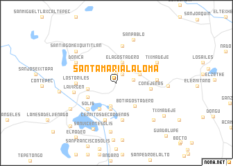
Santa María la Loma (México, Mexico)Santa María la Loma is a town in the México region of Mexico. An overview map of the region around Santa María la Loma is displayed below.
regional and 3d topo map of Santa María la Loma, Mexico ::
Santa María la Loma airports ::
The nearest airport is QRO - Queretaro Intercontinental, located 68.6 km north of Santa María la Loma.
Other airports nearby include TLC - Toluca Licenciado Adolfo Lopez Mateos Intl (88.8 km south east), MLM - Morelia General Francisco J Mujica Intl (108.2 km west), MEX - Mexico City Licenciado Benito Juarez Intl (117.6 km south east), PCA - Pachuca Ingeniero Juan Guillermo Villasana (128.4 km east), Nearby towns ::
El Fresno (1.4km north) //
Juandó (1.6km north east) //
El Rincón (2.7km east) //
El Agostadero (3.4km north) //
Los Charcos (3.5km north west) //
Agostadero (3.8km south) //
Puentecillas (3.7km east) //
Calderas (4.3km south) //
Las Mangas (4.5km west) //
Boti Agostadero (4.7km south east) //
San Nicolás Solís (4.9km south west) //
San José (4.9km south west) //
Conejeras (5.3km east) //
Ahuacatitlán (6.1km south) //
San Francisco Saxni (6.1km north) //
Solís (6.0km south west) //
Cerritos de Cárdenas (6.3km south) //
Los Toriles (6.1km west) //
Cañada del Gallo (6.1km east) //
La Virgen (6.6km west) //
Tixmadeje (6.9km north east) //
Donicá (6.9km north west) //
San Pablo (7.4km north) //
San Francisco Tepeolulco (7.9km south) //
Santiago Mexquititlán (7.9km north west) //
San Vicente Solís (8.2km south west) //
Muytejé (7.8km east) //
Doshtejé (8.2km south east) //
San Antonio (8.1km south west) //
[all distances 'as the bird flies' and approximate] 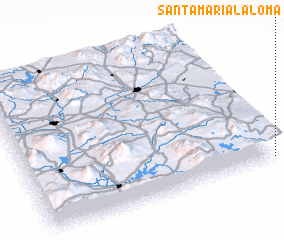 Places with similar names to Santa María la Loma, Mexico ::
// Santa María La Lima (MX)
Disclaimer :: Information on this page comes without warranty of any kind |
||
|
Where is Santa María la Loma? Elevation and coordinates ::
Latitude (lat): 20°1'15"N Longitude (lon): 100°0'30"W
Elevation (approx.): 2695m (map arrows pan, magnifying glasses zoom) |
||
|
Visiting Santa María la Loma? Hotel/Accommodation ::
Book a hotel in Santa María la Loma Travel Guide ::
Buy a travel guide for Mexico rental cars ::
car rental offers GPS waypoint ::
download a GPX waypoint (PoI) of Santa María la Loma for your GPS receiver
|
||