|
search place name
|
||
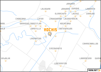
Mochis (Sinaloa, Mexico)Mochis is a town in the Sinaloa region of Mexico. An overview map of the region around Mochis is displayed below.
regional and 3d topo map of Mochis, Mexico ::
Mochis airports ::
The nearest airport is LMM - Los Mochis Valle Del Fuerte Intl, located 25.7 km south of Mochis.
Other airports nearby include CEN - Ciudad Obregon Intl (185.8 km north west), CUL - Culiacan Intl (197.2 km south east), LAP - La Paz General Manuel Marquez De Leon Intl (245.7 km south west), Nearby towns ::
Los Taxtes (1.7km east) //
Sevelbampo (1.7km west) //
La Bajada (4.1km north west) //
Juricahui (5.0km north west) //
Cinco de Mayo (5.8km south) //
Las Higueras (5.8km north) //
Las Varitas (5.3km west) //
Bomba los Taxtes (5.3km east) //
Zapotillo (5.3km west) //
Tastes Viejos (5.3km east) //
Mochicahui (6.2km north east) //
Camayeca (6.2km north west) //
La Tea (6.5km north west) //
San Miguel Zapotitlán (7.6km north west) //
El Ranchito (8.1km north east) //
El Carrizo (8.1km north east) //
La Constancia (8.7km north east) //
El Carricito (8.9km north east) //
[all distances 'as the bird flies' and approximate] 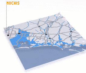 Places with similar names to Mochis, Mexico ::
Disclaimer :: Information on this page comes without warranty of any kind |
||
|
Where is Mochis? Elevation and coordinates ::
Latitude (lat): 25°54'0"N Longitude (lon): 108°59'0"W
Elevation (approx.): 18m (map arrows pan, magnifying glasses zoom) |
||
|
Visiting Mochis? Hotel/Accommodation ::
Book a hotel in Mochis Travel Guide ::
Buy a travel guide for Mexico rental cars ::
car rental offers GPS waypoint ::
download a GPX waypoint (PoI) of Mochis for your GPS receiver
|
||