|
search place name
|
||
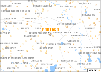
Panteón (México, Mexico)Panteón is a town in the México region of Mexico. An overview map of the region around Panteón is displayed below.
regional and 3d topo map of Panteón, Mexico ::
Panteón airports ::
The nearest airport is TLC - Toluca Licenciado Adolfo Lopez Mateos Intl, located 63.4 km south east of Panteón.
Other airports nearby include QRO - Queretaro Intercontinental (98.2 km north), MEX - Mexico City Licenciado Benito Juarez Intl (101.8 km east), MLM - Morelia General Francisco J Mujica Intl (109.7 km west), CVJ - Cuernavaca General Mariano Matamoros (126.7 km south east), Nearby towns ::
San Juan Coajomulco (0.8km east) //
Casandejé (3.2km north east) //
San Pablo Tlachichilpa (3.4km south west) //
Santiago Casandejé (3.6km north east) //
San Isidro (3.9km north west) //
San Francisco Tlachichilpa (3.9km south west) //
Bojomui (4.2km south west) //
Rosa del Calvario (4.3km west) //
El Capulín (5.0km north west) //
Chotejé (5.1km south west) //
Tlachichilpa (5.1km south west) //
La Jordana (5.5km north) //
San Felipe del Progreso (5.4km south east) //
López Mateos (5.7km north) //
La Concepción (5.8km south) //
Rincón de Pirules (5.5km west) //
San Miguel Tenochtitlán (5.6km east) //
El Calvario (6.0km south east) //
Purisima Concepción Mayorazgo (6.5km south) //
Santa María (6.4km north east) //
El Mayorazgo (6.6km south west) //
Santiago Citendejé (6.7km north east) //
Cuendo (6.9km north east) //
El Carmen Ocotepec (7.3km south) //
El Consuelo (7.0km west) //
Chichilpa (7.1km south west) //
Jalpa (7.5km south east) //
Bassoco (7.7km north west) //
Dotegiare (7.7km south west) //
[all distances 'as the bird flies' and approximate] 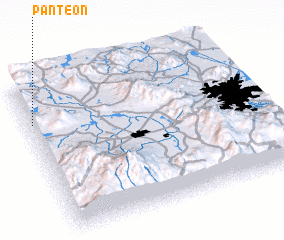 Places with similar names to Panteón, Mexico ::
Disclaimer :: Information on this page comes without warranty of any kind |
||
|
Where is Panteón? Elevation and coordinates ::
Latitude (lat): 19°45'3"N Longitude (lon): 99°59'2"W
Elevation (approx.): 2813m (map arrows pan, magnifying glasses zoom) |
||
|
Visiting Panteón? Hotel/Accommodation ::
Book a hotel in Panteón Travel Guide ::
Buy a travel guide for Mexico rental cars ::
car rental offers GPS waypoint ::
download a GPX waypoint (PoI) of Panteón for your GPS receiver
|
||