|
search place name
|
||
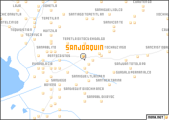
San Joaquín (México, Mexico)San Joaquín is a town in the México region of Mexico. An overview map of the region around San Joaquín is displayed below.
regional and 3d topo map of San Joaquín, Mexico ::
San Joaquín airports ::
The nearest airport is MEX - Mexico City Licenciado Benito Juarez Intl, located 29.6 km south west of San Joaquín.
Other airports nearby include PCA - Pachuca Ingeniero Juan Guillermo Villasana (58.5 km north), PBC - Puebla Hermanos Serdan Intl (63.8 km south east), TXA - Tlaxcala (67.5 km east), TLC - Toluca Licenciado Adolfo Lopez Mateos Intl (82.1 km west), Nearby towns ::
Santa Inés (1.3km south east) //
Molino de Flores (1.9km south) //
San Juan Tezonia (1.7km east) //
La Purificación (2.8km south) //
San Bernardo Tlamimilolpan (3.4km north east) //
Tepetlaoxtoc de Hidalgo (3.7km north) //
San Andrés de las Peras (3.6km east) //
Papalotla (4.0km north west) //
Xocotlán (4.5km south west) //
San Miguel Tlaixpan (4.7km south) //
Jolalpan (5.1km north west) //
Pentecostés (5.2km west) //
Natívitas (5.8km south) //
San Pedro Chauzingo (5.6km east) //
Texopa (5.6km west) //
Tepetitlán (6.4km west) //
Tulantengo (6.4km west) //
San Jerónimo Amanalco (6.7km south east) //
San Dieguito Xochimanca (7.4km south) //
Chimelo (7.2km west) //
Chiautla (7.2km west) //
Santa Catarina (7.6km south east) //
Santa María Tecuanulco (7.6km south east) //
San Diego (7.6km south west) //
Tlatecahuaca (7.9km north west) //
Texcoco de Mora (7.9km south west) //
San Lucas (8.1km north west) //
La Trinidad de Axopilco (8.3km south west) //
San Pablito (8.1km west) //
[all distances 'as the bird flies' and approximate] 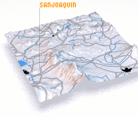 Places with similar names to San Joaquín, Mexico ::
// San Joaquin (BZ)
// San Joaquin (US)
// San Joaquín (PA)
// San Joaquín (CU)
// San Joaquín (CU)
// San Joaquín (CU)
// San Joaquín (CU)
// San Joaquín (CU)
// San Joaquín (CU)
// San Joaquín (CU)
Disclaimer :: Information on this page comes without warranty of any kind |
||
|
Where is San Joaquín? Elevation and coordinates ::
Latitude (lat): 19°33'0"N Longitude (lon): 98°49'0"W
Elevation (approx.): 2347m (map arrows pan, magnifying glasses zoom) |
||
|
Visiting San Joaquín? Hotel/Accommodation ::
Book a hotel in San Joaquín Travel Guide ::
Buy a travel guide for Mexico rental cars ::
car rental offers GPS waypoint ::
download a GPX waypoint (PoI) of San Joaquín for your GPS receiver
|
||