|
search place name
|
||
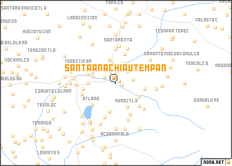
Santa Ana Chiautempan (Tlaxcala, Mexico)Santa Ana Chiautempan is a town in the Tlaxcala region of Mexico. An overview map of the region around Santa Ana Chiautempan is displayed below.
regional and 3d topo map of Santa Ana Chiautempan, Mexico ::
Santa Ana Chiautempan airports ::
The nearest airport is TXA - Tlaxcala, located 24.5 km north of Santa Ana Chiautempan.
Other airports nearby include PBC - Puebla Hermanos Serdan Intl (26.4 km south west), MEX - Mexico City Licenciado Benito Juarez Intl (94.3 km west), PCA - Pachuca Ingeniero Juan Guillermo Villasana (105.1 km north west), TCN - Tehuacan (121.2 km south east), Nearby towns ::
Ixcotla (0.5km north east) //
Santa Cruz Guadalupe (0.9km east) //
San Pablo Apetatitlán (1.9km north) //
Antonio Cano (2.0km north west) //
Ixtulco (2.0km north west) //
Contla (2.5km north east) //
Xaltipan (2.7km east) //
Tecolotla (3.3km north) //
Atlaxac (3.3km north) //
Tepetomatitlán (3.8km north) //
Atemo (3.7km west) //
San Esteban Tizatlán (4.0km north west) //
Muñoztla (4.2km south east) //
Tlalcuapan (4.1km south east) //
Ocotlán (4.2km west) //
Xochitiotla (4.5km east) //
Tlaltelulco (4.7km south) //
Metecatlán (4.8km north) //
Toctlapan (4.6km west) //
Tlacochcalco (4.7km north east) //
Tlalcuapan de Bravo (5.1km south east) //
Atlapa (5.1km south west) //
Cuautla (5.0km west) //
San Bernabé Amaxac de Guerrero (5.6km north) //
Satélite (5.5km south east) //
Santa María Atlihuetzián (5.8km north) //
Acuitlapilco (5.6km west) //
San Vicente Xiloxochitla (5.8km south) //
Santa Marta (6.0km north) //
[all distances 'as the bird flies' and approximate]  Places with similar names to Santa Ana Chiautempan, Mexico :: Disclaimer :: Information on this page comes without warranty of any kind |
||
|
Where is Santa Ana Chiautempan? Elevation and coordinates ::
Latitude (lat): 19°19'0"N Longitude (lon): 98°11'0"W
Elevation (approx.): 2304m (map arrows pan, magnifying glasses zoom) |
||
|
Visiting Santa Ana Chiautempan? Hotel/Accommodation ::
Book a hotel in Santa Ana Chiautempan Travel Guide ::
Buy a travel guide for Mexico rental cars ::
car rental offers GPS waypoint ::
download a GPX waypoint (PoI) of Santa Ana Chiautempan for your GPS receiver
|
||