|
search place name
|
||
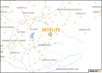
Satélite (Tlaxcala, Mexico)Satélite is a town in the Tlaxcala region of Mexico. An overview map of the region around Satélite is displayed below.
regional and 3d topo map of Satélite, Mexico ::
Satélite airports ::
The nearest airport is PBC - Puebla Hermanos Serdan Intl, located 25.3 km south west of Satélite.
Other airports nearby include TXA - Tlaxcala (29.6 km north), MEX - Mexico City Licenciado Benito Juarez Intl (97.3 km west), PCA - Pachuca Ingeniero Juan Guillermo Villasana (110.5 km north west), TCN - Tehuacan (116.0 km south east), Nearby towns ::
Tetlanohcán (1.0km south) //
Muñoztla (1.3km north) //
Tlalcuapan de Bravo (1.9km north east) //
Chimalpa (2.2km north east) //
Axotla del Monte (2.5km south) //
San Francisco Tetlanohca (2.7km south east) //
Tlalcuapan (3.2km north east) //
San Luis Teolocholco (3.2km south west) //
Tlaltelulco (3.2km west) //
San Vicente Xiloxochitla (4.0km west) //
Xochitiotla (4.7km north east) //
Acuamanalá (4.7km south west) //
Santa Cruz Guadalupe (5.0km north) //
Xioxoxtla (4.8km west) //
Xaltipan (5.6km north) //
Santa Ana Chiautempan (5.5km north west) //
Ixcotla (5.7km north) //
Aztatla (5.7km north east) //
Atlapa (6.0km west) //
Tlacuchca (6.2km west) //
La Aurora (6.3km west) //
Vacaciones (6.3km south west) //
Acuamanala (6.6km south west) //
Cuauhtenco (6.7km north east) //
Contla (7.0km north) //
Olextla (7.2km south west) //
Atlamajac (7.0km south west) //
Chimalpa (7.1km south west) //
San Pablo Apetatitlán (7.3km north) //
[all distances 'as the bird flies' and approximate] 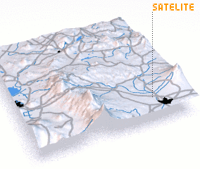 Places with similar names to Satélite, Mexico ::
// Saïdlate (MA)
// Zaouit Louda (MA)
// Setlet (MM)
// Stellata (IT)
// Stalti (LV)
// Ştiuleţi (RO)
// Sidlaghatta (IN)
// Sotolito (MX)
// Stilte (NA)
// Sidi el Aïdi (MA)
Disclaimer :: Information on this page comes without warranty of any kind |
||
|
Where is Satélite? Elevation and coordinates ::
Latitude (lat): 19°16'15"N Longitude (lon): 98°9'45"W
Elevation (approx.): 2437m (map arrows pan, magnifying glasses zoom) |
||
|
Visiting Satélite? Hotel/Accommodation ::
Book a hotel in Satélite Travel Guide ::
Buy a travel guide for Mexico rental cars ::
car rental offers GPS waypoint ::
download a GPX waypoint (PoI) of Satélite for your GPS receiver
|
||