|
search place name
|
||
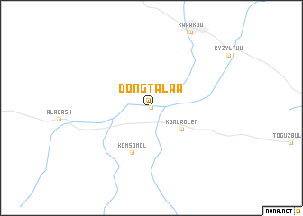
Döng-Talaa (Issyk-Kul'skaya Oblast', Kyrgyzstan)Döng-Talaa is a town in the Issyk-Kul'skaya Oblast' region of Kyrgyzstan. An overview map of the region around Döng-Talaa is displayed below.
regional and 3d topo map of Döng-Talaa, Kyrgyzstan ::
Döng-Talaa airports ::
The nearest airport is ALA - Alma-ata Almaty, located 141.3 km north of Döng-Talaa.
Nearby towns ::
Dën-Talaa (0.0km north) //
Konur-Olën (3.8km south east) //
Komsomol (5.8km south) //
[all distances 'as the bird flies' and approximate] 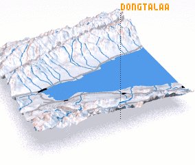 Places with similar names to Döng-Talaa, Kyrgyzstan ::
// Tengdal (NO)
// Tin Agadèl (BF)
// Dangtoli (TD)
// Tongdul-li (KP)
// Tangdŭl (KR)
// Tongdal (KR)
// Tongdal (KR)
// Tongdal-li (KR)
// Doungadala (ML)
// Tongdal-li (KP)
Disclaimer :: Information on this page comes without warranty of any kind |
||
|
Where is Döng-Talaa? Elevation and coordinates ::
Latitude (lat): 42°7'31"N Longitude (lon): 76°34'57"E
Elevation (approx.): 1950m (map arrows pan, magnifying glasses zoom) |
||
|
Visiting Döng-Talaa? Hotel/Accommodation ::
Book a hotel in Döng-Talaa Travel Guide ::
Buy a travel guide for Kyrgyzstan rental cars ::
car rental offers GPS waypoint ::
download a GPX waypoint (PoI) of Döng-Talaa for your GPS receiver
|
||