|
search place name
|
||
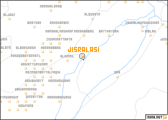
Jisr al ‘Āşī (Béqaa, Lebanon)Jisr al ‘Āşī is a town in the Béqaa region of Lebanon. An overview map of the region around Jisr al ‘Āşī is displayed below.
regional and 3d topo map of Jisr al ‘Āşī, Lebanon ::
Jisr al ‘Āşī airports ::
The nearest airport is BEY - Beirut Rafic Hariri Intl, located 106.0 km south west of Jisr al ‘Āşī.
Other airports nearby include DAM - Damascus Intl (108.3 km south), LTK - Latakia Bassel Al Assad Intl (120.7 km north), RPN - Rosh Pina Mahanaim I Ben Yaakov (174.1 km south west), PMS - Palmyra (175.6 km east), Nearby towns ::
Hermel (3.1km west) //
Al Hirmil (3.1km west) //
Marāḩ ‘Abbās (5.6km north) //
Zighrīn at Taḩtā (5.9km north west) //
Marāḩ Abū Qamar ad Dīn (6.1km west) //
Marāḩ as Sīyād (6.4km west) //
Marāḩ Bayt ‘Allū (6.4km west) //
Marāḩ ‘Abbās (6.4km west) //
Marāḩ ash Shunayn (6.4km west) //
Marāḩ aḑ Ḑahr (7.2km south west) //
Marāḩ Ḩiqāb an Najjār (7.2km south west) //
Bayt Ḩayrah (7.2km north east) //
Marāḩ al Mashraf (7.2km north west) //
Qaa (7.2km south east) //
Marāḩ al ‘Utaybah (7.2km south west) //
Zighrīn (7.2km north west) //
Jāmi‘ Wādī Zighrīn (7.2km north west) //
Ash Sharbīn (8.7km north west) //
[all distances 'as the bird flies' and approximate] 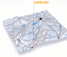 Places with similar names to Jisr al ‘Āşī, Lebanon :: Disclaimer :: Information on this page comes without warranty of any kind |
||
|
Where is Jisr al ‘Āşī? Elevation and coordinates ::
Latitude (lat): 34°23'0"N Longitude (lon): 36°25'0"E
Elevation (approx.): 663m (map arrows pan, magnifying glasses zoom) |
||
|
Visiting Jisr al ‘Āşī? Hotel/Accommodation ::
Book a hotel in Jisr al ‘Āşī Travel Guide ::
Buy a travel guide for Lebanon rental cars ::
car rental offers GPS waypoint ::
download a GPX waypoint (PoI) of Jisr al ‘Āşī for your GPS receiver
|
||