|
search place name
|
||
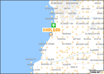
Khaldah (Mont-Liban, Lebanon)Khaldah is a town in the Mont-Liban region of Lebanon. An overview map of the region around Khaldah is displayed below.
regional and 3d topo map of Khaldah, Lebanon ::
Khaldah airports ::
The nearest airport is BEY - Beirut Rafic Hariri Intl, located 4.2 km north of Khaldah.
Other airports nearby include RPN - Rosh Pina Mahanaim I Ben Yaakov (89.4 km south), DAM - Damascus Intl (104.2 km south east), HFA - Haifa (115.5 km south), OMF - Mafraq King Hussein (174.1 km south east), Nearby towns ::
Qubruş (0.0km north) //
Al Yahūdīyah (1.5km east) //
Mīdān az Zīr (2.4km south west) //
Khalawāt ar Ruʼaysah (3.1km east) //
Dayr Mār Jirjis (4.0km south west) //
Nā‘imat al Fawqā (4.0km south west) //
‘Ayn Drāfīl (4.0km south east) //
Khalwat al Munsī (3.6km south east) //
‘Aramūn (3.6km south east) //
Sraḩmūl (3.6km south east) //
Dayr Qūbil (3.6km north east) //
Al Qubbah (3.6km north east) //
Raʼs Māmā (3.6km north east) //
Al Umarāʼ (3.6km north east) //
Ash Shuwayfāt (4.1km north east) //
Ḑahr ash Shaqīf (4.8km south west) //
Ba‘l an Nā‘imah (4.8km south west) //
Al Mighrāqah (4.8km south west) //
Al ‘Amrūsīyah (4.8km north east) //
Mudawwarah (5.6km north) //
‘Ayn ‘Nūb (4.6km east) //
Bshāmūn (4.6km east) //
El Boustâne (5.6km south east) //
Burj al Barājinah (5.8km north) //
Ḩārat at Taḩtā (5.8km south) //
Bi‘wirtā (5.8km south) //
El Moughraïqa (5.7km south east) //
El Hallâli (6.0km south east) //
Kafr Shīmā (5.8km north east) //
[all distances 'as the bird flies' and approximate] 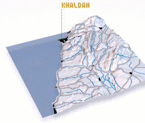 Places with similar names to Khaldah, Lebanon ::
Disclaimer :: Information on this page comes without warranty of any kind |
||
|
Where is Khaldah? Elevation and coordinates ::
Latitude (lat): 33°47'0"N Longitude (lon): 35°29'0"E
Elevation (approx.): 130m (map arrows pan, magnifying glasses zoom) |
||
|
Visiting Khaldah? Hotel/Accommodation ::
Book a hotel in Khaldah Travel Guide ::
Buy a travel guide for Lebanon rental cars ::
car rental offers GPS waypoint ::
download a GPX waypoint (PoI) of Khaldah for your GPS receiver
|
||