|
search place name
|
||
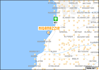
Mīdān az Zīr (Mont-Liban, Lebanon)Mīdān az Zīr is a town in the Mont-Liban region of Lebanon. An overview map of the region around Mīdān az Zīr is displayed below.
regional and 3d topo map of Mīdān az Zīr, Lebanon ::
Mīdān az Zīr airports ::
The nearest airport is BEY - Beirut Rafic Hariri Intl, located 6.3 km north of Mīdān az Zīr.
Other airports nearby include RPN - Rosh Pina Mahanaim I Ben Yaakov (87.7 km south), DAM - Damascus Intl (105.0 km east), HFA - Haifa (113.3 km south), OMF - Mafraq King Hussein (173.0 km south east), Nearby towns ::
Dayr Mār Jirjis (1.9km south) //
Nā‘imat al Fawqā (1.9km south) //
Khaldah (2.4km north east) //
Qubruş (2.4km north east) //
Al Mighrāqah (2.4km south west) //
Ba‘l an Nā‘imah (2.4km south west) //
Ḑahr ash Shaqīf (2.4km south west) //
Al Yahūdīyah (3.6km north east) //
‘Ayn Drāfīl (3.6km south east) //
Ash Sharqīyah (4.0km south west) //
Mazra‘at an Nahr (4.0km south west) //
Az Zḩīt (4.0km south west) //
Mār Ilyās (4.0km south west) //
Ḩārat al Fawqā (4.0km south west) //
Ḩārat an Nā‘imah (4.0km south west) //
Ḩārat ar Ruʼūs (4.0km south west) //
Damour (4.2km south) //
Ḩārat at Taḩtā (4.8km south east) //
Bi‘wirtā (4.8km south east) //
Khalwat al Munsī (4.6km east) //
Al Ḩamrāʼ (5.6km south) //
Sraḩmūl (4.6km east) //
‘Aramūn (4.6km east) //
El Moughraïqa (5.1km south east) //
El Boustâne (5.1km south east) //
Khalawāt ar Ruʼaysah (5.0km east) //
Judaydah (5.8km south) //
Mār Mīkhāʼīl (5.8km south) //
Al Qāţi‘ (5.8km south) //
[all distances 'as the bird flies' and approximate] 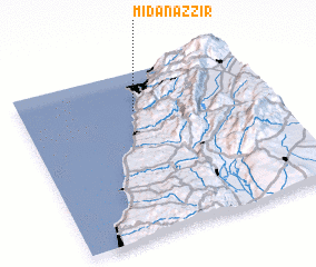 Places with similar names to Mīdān az Zīr, Lebanon ::
// Mīt an Naşārá (EG)
// Mīt an Naşārá (EG)
// Madenşehri (TR)
// Mutnozero (RU)
// Médina Sar (SN)
// Meydān Sar (IR)
// Meydān Sar (IR)
// Ma‘tan as Sārah (LY)
// Ma‘dan-e Zarī (IR)
// Matinsaari (FI)
Disclaimer :: Information on this page comes without warranty of any kind |
||
|
Where is Mīdān az Zīr? Elevation and coordinates ::
Latitude (lat): 33°46'0"N Longitude (lon): 35°28'0"E
Elevation (approx.): 37m (map arrows pan, magnifying glasses zoom) |
||
|
Visiting Mīdān az Zīr? Hotel/Accommodation ::
Book a hotel in Mīdān az Zīr Travel Guide ::
Buy a travel guide for Lebanon rental cars ::
car rental offers GPS waypoint ::
download a GPX waypoint (PoI) of Mīdān az Zīr for your GPS receiver
|
||