|
search place name
|
||
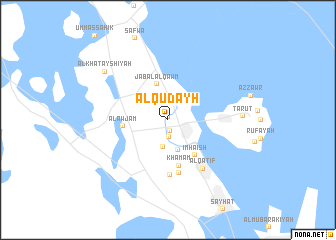
Al Qudayḩ (Ash Sharqīyah, Saudi Arabia)Al Qudayḩ is a town in the Ash Sharqīyah region of Saudi Arabia. An overview map of the region around Al Qudayḩ is displayed below.
regional and 3d topo map of Al Qudayḩ, Saudi Arabia ::
Al Qudayḩ airports ::
The nearest airport is DMM - Dammam King Fahd Intl, located 21.9 km south west of Al Qudayḩ.
Other airports nearby include DHA - Dhahran King Abdulaziz Ab (37.3 km south east), BAH - Bahrain Intl (72.2 km south east), LEA - Al-ahsa Al Ahsa (150.9 km south), DOH - Doha Intl (214.3 km south east), Nearby towns ::
Qudayḩ (0.3km north) //
At Tūbī (1.3km south) //
Khuwaylīdīyah (2.0km south) //
Al ‘Awāmīyah (2.8km north) //
Jarūdīyah (3.1km south) //
Ḩillat Muḩīsh (3.5km south) //
Jabal al Qawm (4.2km north) //
‘Ank (4.8km south east) //
Imhaish (4.8km south east) //
Al Awjām (4.6km west) //
Khamam (5.2km south) //
Mallāḩah (6.0km south) //
Jish (6.2km south) //
Al Qaţīf (6.5km south east) //
Tārūt (7.5km east) //
Al Khatayshīyah (8.3km north west) //
[all distances 'as the bird flies' and approximate]  Places with similar names to Al Qudayḩ, Saudi Arabia ::
Disclaimer :: Information on this page comes without warranty of any kind |
||
|
Where is Al Qudayḩ? Elevation and coordinates ::
Latitude (lat): 26°34'8"N Longitude (lon): 49°59'22"E
Elevation (approx.): 13m (map arrows pan, magnifying glasses zoom) |
||
|
Visiting Al Qudayḩ? Hotel/Accommodation ::
Book a hotel in Al Qudayḩ Travel Guide ::
rental cars ::
car rental offers GPS waypoint ::
download a GPX waypoint (PoI) of Al Qudayḩ for your GPS receiver
|
||