|
search place name
|
||
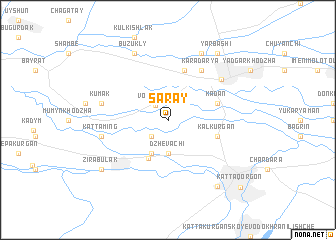
Saray (Uzbekistan)Saray is a town in Uzbekistan. An overview map of the region around Saray is displayed below.
regional and 3d topo map of Saray, Uzbekistan ::
Saray airports ::
The nearest airport is SKD - Samarkand, located 74.6 km south east of Saray.
Other airports nearby include BHK - Bukhara (147.0 km west), Nearby towns ::
Volʼdzhan (2.0km north west) //
Karakulʼ (2.3km south west) //
Dzhevachi (3.7km south) //
Dzhalair (4.0km south) //
Charhin (4.6km south) //
Kadan (4.6km north east) //
Kalʼ-Kurgan (4.6km south east) //
Tavaroy (5.7km north) //
Kara-Darʼya (6.2km north east) //
Payshanba (6.5km north east) //
Kumak (6.0km west) //
Kattaming (6.0km west) //
Buzukly (7.9km north) //
Dzhalair (7.9km north) //
Yarbashi (8.5km north east) //
Zirabulak (8.0km south west) //
Amanbay (8.6km south east) //
Kattaqo'rg'on (9.8km south east) //
[all distances 'as the bird flies' and approximate] 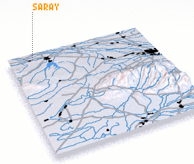 Places with similar names to Saray, Uzbekistan ::
Disclaimer :: Information on this page comes without warranty of any kind |
||
|
Where is Saray? Elevation and coordinates ::
Latitude (lat): 39°58'0"N Longitude (lon): 66°11'0"E
Elevation (approx.): 450m (map arrows pan, magnifying glasses zoom) |
||
|
Visiting Saray? Hotel/Accommodation ::
Book a hotel in Saray Travel Guide ::
Buy a travel guide for Uzbekistan rental cars ::
car rental offers GPS waypoint ::
download a GPX waypoint (PoI) of Saray for your GPS receiver
|
||