|
search place name
|
||
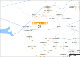
Sary-Kunda (Uzbekistan)Sary-Kunda is a town in Uzbekistan. An overview map of the region around Sary-Kunda is displayed below.
regional and 3d topo map of Sary-Kunda, Uzbekistan ::
Sary-Kunda airports ::
The nearest airport is BHK - Bukhara, located 34.9 km south east of Sary-Kunda.
Nearby towns ::
Kiyat-Khodzha (1.9km north) //
Kokush-Tuvan (4.3km west) //
Kurgan-Kuchna (4.6km south west) //
Kara-Tyube (5.7km north) //
Khafiz-Rabat (6.2km south west) //
Kurgan (6.2km south west) //
Yagmur (6.2km south east) //
Kuchak (5.6km north east) //
Marziya (6.2km south west) //
Dzhagary (5.7km east) //
Naupashi (7.5km south) //
Shavari (7.5km north) //
Tali-Sobun (7.9km north) //
Ryspanak (7.9km south east) //
Utabek (9.3km south east) //
[all distances 'as the bird flies' and approximate] 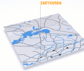 Places with similar names to Sary-Kunda, Uzbekistan ::
// Şorkǝnd (AZ)
// Şurakǝnd (AZ)
// Şurakǝnd (AZ)
// Şurakǝnd (AZ)
// Cerro Cañito (PA)
// Saraykent (TR)
// Sarıkent (TR)
// Sarai Kānda (BD)
// Serkāndi (BD)
// Soārkāndi (BD)
Disclaimer :: Information on this page comes without warranty of any kind |
||
|
Where is Sary-Kunda? Elevation and coordinates ::
Latitude (lat): 40°2'0"N Longitude (lon): 64°15'0"E
Elevation (approx.): 221m (map arrows pan, magnifying glasses zoom) |
||
|
Visiting Sary-Kunda? Hotel/Accommodation ::
Book a hotel in Sary-Kunda Travel Guide ::
Buy a travel guide for Uzbekistan rental cars ::
car rental offers GPS waypoint ::
download a GPX waypoint (PoI) of Sary-Kunda for your GPS receiver
|
||