|
search place name
|
||
Alor Lubok (Kedah, Malaysia)Alor Lubok is a town in the Kedah region of Malaysia. An overview map of the region around Alor Lubok is displayed below.
regional and 3d topo map of Alor Lubok, Malaysia ::

Alor Lubok airports ::
The nearest airport is AOR - Alor Setar Sultan Abdul Halim, located 12.4 km north of Alor Lubok.
Other airports nearby include LGK - Pulau Langkawi Intl (82.6 km west), PEN - Penang Intl (88.7 km south), HDY - Songkhla Hat Yai Intl (94.1 km north), PAN - Pattani (111.3 km north east), Nearby towns ::
Kampong Terus (0.0km north) //
Kampong Telok Kandai (1.8km west) //
Kampong Kelompang (1.8km west) //
Kampong Telok Kandis (1.8km west) //
Kampong Padang Terus (1.9km north) //
Kampong Lubok Lunas (1.8km east) //
Kampong Alor Asam Jawa (1.8km east) //
Kampong Tok Sibil (2.6km south west) //
Kampong Tok Keling (2.6km south west) //
Kampong Padang (2.6km south east) //
Kampong Alor Binjal (2.6km south east) //
Kampong Tajar (2.6km north west) //
Lipat Songgol (2.6km north west) //
Kampong Alor Melintang (2.6km north west) //
Kampong Salai Badak (2.6km north east) //
Kampong Alor Penyengat (3.7km west) //
Kampong Bokbok (3.7km south) //
Kampong Padang Patani (3.7km north) //
Kampong Gelam Segompong (3.7km north) //
Kampong Gelam (3.7km north) //
Alor Pak Ngah (3.7km east) //
Kampong Titi Haji Idris (3.7km east) //
Kampong Alor Belat (4.1km south west) //
Kampong Tanjong Bayam (4.1km south west) //
Kampong Lahar Budi (4.1km south west) //
Kampong Gerigis (4.1km north west) //
Kampong Lubok Pupok (4.1km north west) //
Kampong Kuar (4.1km south east) //
Kampong Tok Pauh (4.1km south east) //
[all distances 'as the bird flies' and approximate] 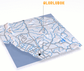 Places with similar names to Alor Lubok, Malaysia :: Disclaimer :: Information on this page comes without warranty of any kind |
||
|
Where is Alor Lubok? Elevation and coordinates ::
Latitude (lat): 6°5'0"N Longitude (lon): 100°26'0"E
Elevation (approx.): 5m (map arrows pan, magnifying glasses zoom) |
||
|
Visiting Alor Lubok? Hotel/Accommodation ::
Book a hotel in Alor Lubok Travel Guide ::
Buy a travel guide for Malaysia rental cars ::
car rental offers GPS waypoint ::
download a GPX waypoint (PoI) of Alor Lubok for your GPS receiver
|
||