|
search place name
|
||
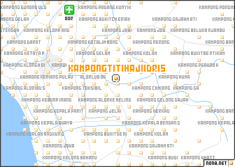
Kampong Titi Haji Idris (Kedah, Malaysia)Kampong Titi Haji Idris is a town in the Kedah region of Malaysia. An overview map of the region around Kampong Titi Haji Idris is displayed below.
regional and 3d topo map of Kampong Titi Haji Idris, Malaysia ::
Kampong Titi Haji Idris airports ::
The nearest airport is AOR - Alor Setar Sultan Abdul Halim, located 14.0 km north west of Kampong Titi Haji Idris.
Other airports nearby include LGK - Pulau Langkawi Intl (86.1 km west), PEN - Penang Intl (89.4 km south), HDY - Songkhla Hat Yai Intl (94.3 km north), PAN - Pattani (108.6 km north east), Nearby towns ::
Alor Pak Ngah (0.0km north) //
Kampong Alor China (1.8km east) //
Kampong Banggol Senu (1.8km east) //
Kampong Kelopak Jantan (1.9km south) //
Kampong Banggol Tengah (1.9km south) //
Kampong Alor Asam Jawa (1.8km west) //
Kampong Lubok Lunas (1.8km west) //
Kampong Tualang (2.6km north east) //
Kampong Tengah (2.6km north east) //
Kampong Alor Binjal (2.6km south west) //
Kampong Padang (2.6km south west) //
Kampong Salai Badak (2.6km north west) //
Kampong Bukit Sekech (3.7km east) //
Kampong Alor Mengkuang (3.7km south) //
Kampong Banggol Terus (3.7km south) //
Kampong Kepala Bukit (3.7km north) //
Kampong Masjid Lama (3.7km north) //
Kampong Terus (3.7km west) //
Alor Lubok (3.7km west) //
Kampung Tobiar (4.1km south east) //
Kampong Balek Bukit (4.1km south east) //
Kampong Alor Pudak (4.1km south east) //
Kampong Matang Limau (4.1km north east) //
Kampong Alor Kemeling (4.1km south west) //
Kampong Tok Pauh (4.1km south west) //
Kampong Kuar (4.1km south west) //
Kampong Kepala Bendang (4.1km north east) //
Kampong Hutan Gelam (4.1km north west) //
Kampong Saudagar (4.1km north west) //
[all distances 'as the bird flies' and approximate]  Places with similar names to Kampong Titi Haji Idris, Malaysia :: Disclaimer :: Information on this page comes without warranty of any kind |
||
|
Where is Kampong Titi Haji Idris? Elevation and coordinates ::
Latitude (lat): 6°5'0"N Longitude (lon): 100°28'0"E
Elevation (approx.): 6m (map arrows pan, magnifying glasses zoom) |
||
|
Visiting Kampong Titi Haji Idris? Hotel/Accommodation ::
Book a hotel in Kampong Titi Haji Idris Travel Guide ::
Buy a travel guide for Malaysia rental cars ::
car rental offers GPS waypoint ::
download a GPX waypoint (PoI) of Kampong Titi Haji Idris for your GPS receiver
|
||