|
search place name
|
||
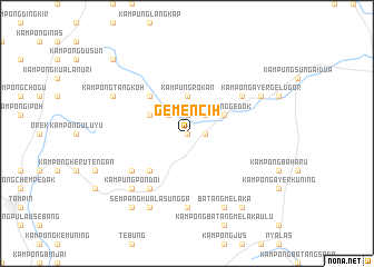
Gemencih (Negeri Sembilan, Malaysia)Gemencih is a town in the Negeri Sembilan region of Malaysia. An overview map of the region around Gemencih is displayed below.
regional and 3d topo map of Gemencih, Malaysia ::
Gemencih airports ::
The nearest airport is MKZ - Malacca, located 33.3 km south west of Gemencih.
Other airports nearby include KUL - Kuala Lumpur Intl (78.5 km west), DUM - Dumai Pinang Kampai (147.0 km south west), KUA - Kuantan (165.2 km north east), JHB - Johor Bahru Sultan Ismail (173.8 km south east), Nearby towns ::
Kampong Ayer Hati (0.0km north) //
Kampong Pulau (0.0km north) //
Kampong Masjid Lama (1.9km north) //
Kampong Ayer Rawah (1.9km north) //
Kampong Ayer Kelubi (1.9km north) //
Gemencheh (1.9km east) //
Kampong Asahan (1.9km east) //
Kampong Sungai Kepong (2.6km north west) //
Kampong Sungai Jerneh (2.6km north west) //
Kampong Tebat Kering (2.6km north west) //
Kampong Ayer Rawa (2.6km north west) //
Kampong Tanjong Melintang (2.6km north east) //
Kampung Rokan (3.7km north) //
Kampong Sungai Lerek (4.1km north west) //
Kampong Sungai Penaga (4.1km north west) //
Kampong Gedok (4.1km north east) //
Kampong Tengah (4.1km north east) //
Gedok New Village (4.1km north east) //
Kampong Tebong Dalam (5.2km south west) //
Kampong Salak (5.2km north west) //
Kampong Ulu Pondoi (6.7km south west) //
Kampong Solok Bukit Putus (6.7km south west) //
Kampong Ayer Durian (6.7km north east) //
On Lok Village (7.4km south) //
Kampung Pondoi (7.9km south west) //
Sempang Kuala Sungga (8.3km south west) //
Kampong Solok Kuala Sungga (8.3km south west) //
Kampong Tengah (8.3km south east) //
Batang Melaka (8.3km south east) //
[all distances 'as the bird flies' and approximate]  Places with similar names to Gemencih, Malaysia ::
Disclaimer :: Information on this page comes without warranty of any kind |
||
|
Where is Gemencih? Elevation and coordinates ::
Latitude (lat): 2°32'0"N Longitude (lon): 102°23'0"E
Elevation (approx.): 91m (map arrows pan, magnifying glasses zoom) |
||
|
Visiting Gemencih? Hotel/Accommodation ::
Book a hotel in Gemencih Travel Guide ::
Buy a travel guide for Malaysia rental cars ::
car rental offers GPS waypoint ::
download a GPX waypoint (PoI) of Gemencih for your GPS receiver
|
||