|
search place name
|
||
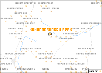
Kampong Sungai Lerek (Negeri Sembilan, Malaysia)Kampong Sungai Lerek is a town in the Negeri Sembilan region of Malaysia. An overview map of the region around Kampong Sungai Lerek is displayed below.
regional and 3d topo map of Kampong Sungai Lerek, Malaysia ::
Kampong Sungai Lerek airports ::
The nearest airport is MKZ - Malacca, located 33.5 km south of Kampong Sungai Lerek.
Other airports nearby include KUL - Kuala Lumpur Intl (74.4 km west), DUM - Dumai Pinang Kampai (145.7 km south west), KUA - Kuantan (165.8 km north east), JHB - Johor Bahru Sultan Ismail (177.9 km south east), Nearby towns ::
Kampong Sungai Penaga (0.0km north) //
Kampong Salak (1.9km north) //
Kampong Ayer Rawa (1.9km east) //
Kampong Tebat Kering (1.9km east) //
Kampong Sungai Kepong (1.9km east) //
Kampong Sungai Jerneh (1.9km east) //
Kampong Ayer Kelubi (3.7km east) //
Kampong Masjid Lama (3.7km east) //
Kampong Ayer Rawah (3.7km east) //
Kampong Tangkoh (4.1km north west) //
Gemencih (4.1km south east) //
Kampong Ayer Hati (4.1km south east) //
Kampung Rokan (4.1km north east) //
Kampong Pulau (4.1km south east) //
Kampong Tebong Dalam (5.6km south) //
Kampong Tanjong Melintang (5.6km east) //
Kampong Ulu Pondoi (5.9km south) //
Kampong Asahan (5.9km east) //
Gemencheh (5.9km east) //
Sungai Johol (6.7km north west) //
Kampong Gedok (7.4km east) //
Gedok New Village (7.4km east) //
Kampong Tengah (7.4km east) //
Kampong Solok Bukit Putus (7.4km south) //
Kampung Pondoi (7.6km south) //
Kampong Ulu Yu (7.6km west) //
Kampong Ulu Dusun (7.9km south west) //
Kampong Tanjong Alai (9.3km south west) //
Kampong Keru Tengan (9.3km south west) //
[all distances 'as the bird flies' and approximate] 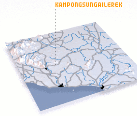 Places with similar names to Kampong Sungai Lerek, Malaysia :: Disclaimer :: Information on this page comes without warranty of any kind |
||
|
Where is Kampong Sungai Lerek? Elevation and coordinates ::
Latitude (lat): 2°33'0"N Longitude (lon): 102°21'0"E
Elevation (approx.): 123m (map arrows pan, magnifying glasses zoom) |
||
|
Visiting Kampong Sungai Lerek? Hotel/Accommodation ::
Book a hotel in Kampong Sungai Lerek Travel Guide ::
Buy a travel guide for Malaysia rental cars ::
car rental offers GPS waypoint ::
download a GPX waypoint (PoI) of Kampong Sungai Lerek for your GPS receiver
|
||