|
search place name
|
||
Kampong Bandar Tinggi (Negeri Sembilan, Malaysia)Kampong Bandar Tinggi is a town in the Negeri Sembilan region of Malaysia. An overview map of the region around Kampong Bandar Tinggi is displayed below.
regional and 3d topo map of Kampong Bandar Tinggi, Malaysia ::

Kampong Bandar Tinggi airports ::
The nearest airport is KUL - Kuala Lumpur Intl, located 47.3 km south west of Kampong Bandar Tinggi.
Other airports nearby include MKZ - Malacca (78.2 km south), KUA - Kuantan (154.9 km north east), DUM - Dumai Pinang Kampai (164.9 km south west), IPH - Ipoh Sultan Azlan Shah (210.1 km north west), Nearby towns ::
Kampong Larong (0.0km north) //
Kampong Piangu (1.9km west) //
Kampong Dundang (1.9km east) //
Kampong Merbau (1.9km east) //
Kampong Chenor (1.9km east) //
Kampong Kuala Jelin (1.9km east) //
Kampong Semedak (1.9km north) //
Kampong Jelebu (1.9km south) //
Kuala Kelawang (1.9km south) //
Kampong Sarin (1.9km south) //
Kampong Binjai (2.6km south west) //
Kampong Ulu Jelebu (3.7km south) //
Kampong Pejadi (3.7km south) //
Kampong Kampai (3.7km east) //
Kampong Tanjong (4.1km south west) //
Kampong Tambun (4.1km south west) //
Kampong Relai (4.1km north east) //
Kampong Kuala Pah (4.1km north east) //
Kampong Seperi (5.2km north west) //
Kampong Kemin (5.2km south west) //
Kampong Purun (5.2km north east) //
Titi (5.6km north) //
Kampong Darang Tujoh (5.6km north) //
Kampong Gepu (5.6km south) //
Kampong Durian Gasing (5.6km west) //
Kampong Gagu (5.6km west) //
Kampong Teriang (5.6km west) //
Kampong Chenerak (5.6km west) //
Kampong Ulu Kemin (5.9km south) //
[all distances 'as the bird flies' and approximate] 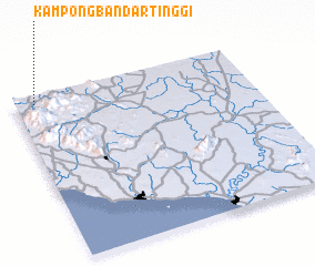 Places with similar names to Kampong Bandar Tinggi, Malaysia :: Disclaimer :: Information on this page comes without warranty of any kind |
||
|
Where is Kampong Bandar Tinggi? Elevation and coordinates ::
Latitude (lat): 2°57'0"N Longitude (lon): 102°5'0"E
Elevation (approx.): 127m (map arrows pan, magnifying glasses zoom) |
||
|
Visiting Kampong Bandar Tinggi? Hotel/Accommodation ::
Book a hotel in Kampong Bandar Tinggi Travel Guide ::
Buy a travel guide for Malaysia rental cars ::
car rental offers GPS waypoint ::
download a GPX waypoint (PoI) of Kampong Bandar Tinggi for your GPS receiver
|
||