|
search place name
|
||
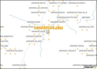
Kampong Pejadi (Negeri Sembilan, Malaysia)Kampong Pejadi is a town in the Negeri Sembilan region of Malaysia. An overview map of the region around Kampong Pejadi is displayed below.
regional and 3d topo map of Kampong Pejadi, Malaysia ::
Kampong Pejadi airports ::
The nearest airport is KUL - Kuala Lumpur Intl, located 45.6 km south west of Kampong Pejadi.
Other airports nearby include MKZ - Malacca (74.6 km south), KUA - Kuantan (157.1 km north east), DUM - Dumai Pinang Kampai (161.6 km south west), IPH - Ipoh Sultan Azlan Shah (213.2 km north west), Nearby towns ::
Kampong Ulu Jelebu (0.0km north) //
Kampong Jelebu (1.9km north) //
Kuala Kelawang (1.9km north) //
Kampong Sarin (1.9km north) //
Kampong Tanjong (1.9km west) //
Kampong Gepu (1.9km south) //
Kampong Binjai (2.6km north west) //
Kampong Ulu Kemin (2.6km south west) //
Kampong Larong (3.7km north) //
Kampong Bandar Tinggi (3.7km north) //
Kampong Kemin (3.7km west) //
Kampong Piangu (4.1km north west) //
Kampong Tambun (4.1km north west) //
Kampong Kuala Jelin (4.1km north east) //
Kampong Dundang (4.1km north east) //
Kampong Merbau (4.1km north east) //
Kampong Chenor (4.1km north east) //
Kampong Kampai (5.2km north east) //
Kampong Semedak (5.6km north) //
Kampong Batu Serambai (5.6km west) //
Kampong Pengenting (5.9km west) //
Kampong Serendah (5.9km west) //
Kampong Berangan (5.9km west) //
Kampong Bukit (5.9km west) //
Kampong Chacha (5.9km west) //
Kampong Chenerak (6.7km north west) //
Kampong Teriang (6.7km north west) //
Kampong Gagu (6.7km north west) //
Kampong Durian Gasing (6.7km north west) //
[all distances 'as the bird flies' and approximate]  Places with similar names to Kampong Pejadi, Malaysia ::
// Kampong Pujut (MY)
Disclaimer :: Information on this page comes without warranty of any kind |
||
|
Where is Kampong Pejadi? Elevation and coordinates ::
Latitude (lat): 2°55'0"N Longitude (lon): 102°5'0"E
Elevation (approx.): 174m (map arrows pan, magnifying glasses zoom) |
||
|
Visiting Kampong Pejadi? Hotel/Accommodation ::
Book a hotel in Kampong Pejadi Travel Guide ::
Buy a travel guide for Malaysia rental cars ::
car rental offers GPS waypoint ::
download a GPX waypoint (PoI) of Kampong Pejadi for your GPS receiver
|
||