|
search place name
|
||
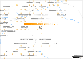
Kampong Batang Kepis (Negeri Sembilan, Malaysia)Kampong Batang Kepis is a town in the Negeri Sembilan region of Malaysia. An overview map of the region around Kampong Batang Kepis is displayed below.
regional and 3d topo map of Kampong Batang Kepis, Malaysia ::
Kampong Batang Kepis airports ::
The nearest airport is MKZ - Malacca, located 48.8 km south of Kampong Batang Kepis.
Other airports nearby include KUL - Kuala Lumpur Intl (67.7 km west), KUA - Kuantan (154.8 km north east), DUM - Dumai Pinang Kampai (155.6 km south west), JHB - Johor Bahru Sultan Ismail (190.7 km south east), Nearby towns ::
Kampong Solok (0.0km north) //
Kampong Kepis (0.0km north) //
Kampung Malan (1.9km south) //
Kampong Ayer Besar (1.9km west) //
Kampong Rambang Panas (3.7km north) //
Kampong Sungai Dua Besar (5.2km north west) //
Kampong Melana (5.6km north) //
Kampong Dangi (5.6km south) //
Kampong Gedon (5.9km south) //
Kampong Titian Teras (5.9km west) //
Kampong Dioh Besar (6.7km north west) //
Kampong Sungkak (6.7km north west) //
Kampong Sungai Dua Kechil (6.7km north west) //
Kampong Peraku (7.4km west) //
Kampong Senaling (7.4km west) //
Senaling (7.4km west) //
Kampong Rembang Panas (7.4km north) //
Kampong Tulang Rimau (7.4km south) //
Kampong Sawah Lebar (7.9km north west) //
Kampong Ayer Runtoh (7.9km south west) //
Kampung Langkap (8.3km south east) //
Kuala Pilah (8.3km north west) //
Kampong Sungai Dua Besar (8.3km north west) //
Kampong Sungai Jerneh (8.3km north west) //
Kampong Kuala Sungkak (8.3km north west) //
Kampong Sungai Dua (8.3km north west) //
Kampong Senibai (8.3km south west) //
Pelangei (9.3km north west) //
Kampong Pulau Pandan (9.3km north west) //
[all distances 'as the bird flies' and approximate] 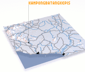 Places with similar names to Kampong Batang Kepis, Malaysia :: Disclaimer :: Information on this page comes without warranty of any kind |
||
|
Where is Kampong Batang Kepis? Elevation and coordinates ::
Latitude (lat): 2°42'0"N Longitude (lon): 102°19'0"E
Elevation (approx.): 135m (map arrows pan, magnifying glasses zoom) |
||
|
Visiting Kampong Batang Kepis? Hotel/Accommodation ::
Book a hotel in Kampong Batang Kepis Travel Guide ::
Buy a travel guide for Malaysia rental cars ::
car rental offers GPS waypoint ::
download a GPX waypoint (PoI) of Kampong Batang Kepis for your GPS receiver
|
||