|
search place name
|
||
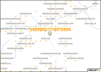
Kampong Titian Teras (Negeri Sembilan, Malaysia)Kampong Titian Teras is a town in the Negeri Sembilan region of Malaysia. An overview map of the region around Kampong Titian Teras is displayed below.
regional and 3d topo map of Kampong Titian Teras, Malaysia ::
Kampong Titian Teras airports ::
The nearest airport is MKZ - Malacca, located 50.2 km south of Kampong Titian Teras.
Other airports nearby include KUL - Kuala Lumpur Intl (62.0 km west), DUM - Dumai Pinang Kampai (153.6 km south west), KUA - Kuantan (157.1 km north east), JHB - Johor Bahru Sultan Ismail (196.2 km south east), Nearby towns ::
Kampong Dioh Besar (1.9km north) //
Kampong Sungai Dua Besar (2.6km north east) //
Kuala Pilah (2.6km north west) //
Kampong Senaling (2.6km south west) //
Senaling (2.6km south west) //
Kampong Peraku (2.6km south west) //
Kampong Sawah Lebar (3.7km north) //
Kampong Sungai Dua Kechil (4.1km north east) //
Kampong Sungkak (4.1km north east) //
Kampong Ayer Besar (4.1km south east) //
Kampong Gantam (4.1km north west) //
Kampong Gemuroh (4.1km north west) //
Kampong Gemelang (4.1km north west) //
Kampong Angga Bisa (4.1km south west) //
Kampong Terap (4.1km south west) //
Kampong Cheriau (4.1km south west) //
Kampong Tanah Melintang (4.1km south west) //
Kampong Parit Seberang (5.2km north west) //
Pelangei (5.6km north) //
Kampong Pelangai Ulu (5.6km north) //
Kampong Pulau Pandan (5.6km north) //
Kampong Kayu Ara (5.9km west) //
Kampong Rambang Panas (5.9km east) //
Kampong Sungai Jerneh (5.9km north) //
Kampong Sungai Dua (5.9km north) //
Kampong Sungai Dua Besar (5.9km north) //
Kampong Kuala Sungkak (5.9km north) //
Kampong Solok (5.9km east) //
Kampong Batang Kepis (5.9km east) //
[all distances 'as the bird flies' and approximate] 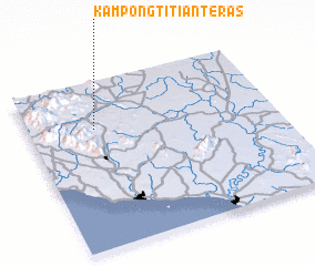 Places with similar names to Kampong Titian Teras, Malaysia :: Disclaimer :: Information on this page comes without warranty of any kind |
||
|
Where is Kampong Titian Teras? Elevation and coordinates ::
Latitude (lat): 2°43'0"N Longitude (lon): 102°16'0"E
Elevation (approx.): 146m (map arrows pan, magnifying glasses zoom) |
||
|
Visiting Kampong Titian Teras? Hotel/Accommodation ::
Book a hotel in Kampong Titian Teras Travel Guide ::
Buy a travel guide for Malaysia rental cars ::
car rental offers GPS waypoint ::
download a GPX waypoint (PoI) of Kampong Titian Teras for your GPS receiver
|
||