|
search place name
|
||
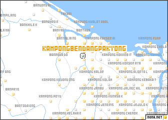
Kampong Bendang Pak Yong (Kelantan, Malaysia)Kampong Bendang Pak Yong is a town in the Kelantan region of Malaysia. An overview map of the region around Kampong Bendang Pak Yong is displayed below.
regional and 3d topo map of Kampong Bendang Pak Yong, Malaysia ::
Kampong Bendang Pak Yong airports ::
The nearest airport is KBR - Kota Bahru Sultan Ismail Petra, located 23.3 km east of Kampong Bendang Pak Yong.
Other airports nearby include NAW - Narathiwat (52.9 km north west), PAN - Pattani (122.5 km north west), TGG - Kuala Terengganu Sultan Mahmud (143.5 km south east), AOR - Alor Setar Sultan Abdul Halim (186.5 km west), Nearby towns ::
Kampong Saring (0.0km north) //
Kampung Simpangan (0.0km north) //
Kampong Kok Beluru (0.0km north) //
Kampong Lado (1.9km south) //
Kampong Naga Ibu (1.9km south) //
Kampong Burong (1.8km east) //
Kampong Parit (1.8km east) //
Kampong Jejulok (1.8km east) //
Kampong Jong Bakar (1.8km east) //
Kampong Jeneris (1.8km east) //
Kampong Sipaengae (1.9km north) //
Ban Bo Kho (2.6km south west) //
Kampong Kajang Sebidang (2.6km south east) //
Kampong Kubang Bemban (2.6km north east) //
Kampong Bunohan (3.7km east) //
Kampong Kok Kenik (3.7km east) //
Kwala Puyu (3.7km north) //
Kampong Tualang (3.7km north) //
Kampong Ngo Kapayaeng (3.7km north) //
Kampong Kok Kedeper (3.7km north) //
Kampung Kuala Jambu (4.1km south east) //
Kampong Kalor (4.1km south east) //
Ban Kuyu (4.1km north west) //
Kampong Kubang Rengit (4.1km south east) //
Kampong Kok Semru (4.1km north east) //
Kampong Kok Pak Keh (4.1km north east) //
Kampong Belukar (4.1km north east) //
Kampong Baroh Kok Pauh (4.1km north east) //
Kampong Ketil (4.1km north east) //
[all distances 'as the bird flies' and approximate] 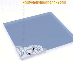 Places with similar names to Kampong Bendang Pak Yong, Malaysia ::
// Kampong Bendang Padang (MY)
// Kampong Bendang Penyengat (MY)
// Kampong Bendang Perang (MY)
// Kampong Bendang Perang (MY)
// Kampong Bendang Pulai (MY)
Disclaimer :: Information on this page comes without warranty of any kind |
||
|
Where is Kampong Bendang Pak Yong? Elevation and coordinates ::
Latitude (lat): 6°11'0"N Longitude (lon): 102°5'0"E
Elevation (approx.): 2m (map arrows pan, magnifying glasses zoom) |
||
|
Visiting Kampong Bendang Pak Yong? Hotel/Accommodation ::
Book a hotel in Kampong Bendang Pak Yong Travel Guide ::
Buy a travel guide for Malaysia rental cars ::
car rental offers GPS waypoint ::
download a GPX waypoint (PoI) of Kampong Bendang Pak Yong for your GPS receiver
|
||