|
search place name
|
||
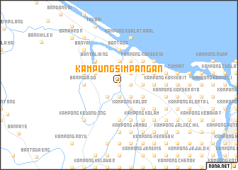
Kampung Simpangan (Kelantan, Malaysia)Kampung Simpangan is a town in the Kelantan region of Malaysia. An overview map of the region around Kampung Simpangan is displayed below.
regional and 3d topo map of Kampung Simpangan, Malaysia ::
Kampung Simpangan airports ::
The nearest airport is KBR - Kota Bahru Sultan Ismail Petra, located 23.3 km east of Kampung Simpangan.
Other airports nearby include NAW - Narathiwat (52.9 km north west), PAN - Pattani (122.5 km north west), TGG - Kuala Terengganu Sultan Mahmud (143.5 km south east), AOR - Alor Setar Sultan Abdul Halim (186.5 km west), Nearby towns ::
Kampong Saring (0.0km north) //
Kampong Bendang Pak Yong (0.0km north) //
Kampong Kok Beluru (0.0km north) //
Kampong Lado (1.9km south) //
Kampong Naga Ibu (1.9km south) //
Kampong Burong (1.8km east) //
Kampong Parit (1.8km east) //
Kampong Jejulok (1.8km east) //
Kampong Jong Bakar (1.8km east) //
Kampong Jeneris (1.8km east) //
Kampong Sipaengae (1.9km north) //
Ban Bo Kho (2.6km south west) //
Kampong Kajang Sebidang (2.6km south east) //
Kampong Kubang Bemban (2.6km north east) //
Kampong Bunohan (3.7km east) //
Kampong Kok Kenik (3.7km east) //
Kwala Puyu (3.7km north) //
Kampong Tualang (3.7km north) //
Kampong Ngo Kapayaeng (3.7km north) //
Kampong Kok Kedeper (3.7km north) //
Kampung Kuala Jambu (4.1km south east) //
Kampong Kalor (4.1km south east) //
Ban Kuyu (4.1km north west) //
Kampong Kubang Rengit (4.1km south east) //
Kampong Kok Semru (4.1km north east) //
Kampong Kok Pak Keh (4.1km north east) //
Kampong Belukar (4.1km north east) //
Kampong Baroh Kok Pauh (4.1km north east) //
Kampong Ketil (4.1km north east) //
[all distances 'as the bird flies' and approximate]  Places with similar names to Kampung Simpangan, Malaysia ::
// Kampong Simpangan (MY)
// Kampong Simpangan Kuala (MY)
Disclaimer :: Information on this page comes without warranty of any kind |
||
|
Where is Kampung Simpangan? Elevation and coordinates ::
Latitude (lat): 6°11'0"N Longitude (lon): 102°5'0"E
Elevation (approx.): 2m (map arrows pan, magnifying glasses zoom) |
||
|
Visiting Kampung Simpangan? Hotel/Accommodation ::
Book a hotel in Kampung Simpangan Travel Guide ::
Buy a travel guide for Malaysia rental cars ::
car rental offers GPS waypoint ::
download a GPX waypoint (PoI) of Kampung Simpangan for your GPS receiver
|
||