|
search place name
|
||
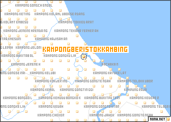
Kampong Beris Tok Kambing (Kelantan, Malaysia)Kampong Beris Tok Kambing is a town in the Kelantan region of Malaysia. An overview map of the region around Kampong Beris Tok Kambing is displayed below.
regional and 3d topo map of Kampong Beris Tok Kambing, Malaysia ::
Kampong Beris Tok Kambing airports ::
The nearest airport is KBR - Kota Bahru Sultan Ismail Petra, located 39.3 km north west of Kampong Beris Tok Kambing.
Other airports nearby include TGG - Kuala Terengganu Sultan Mahmud (87.1 km south east), NAW - Narathiwat (109.2 km north west), PAN - Pattani (178.8 km north west), KTE - Kerteh (180.4 km south east), Nearby towns ::
Kampong Ketik Buloh (0.0km north) //
Kampong Bukit Peraksi (0.0km north) //
Kampong Pengkalan Sena (1.8km west) //
Kampong Pengkalan Pauh (1.8km west) //
Kampong Ketik Nangka (1.8km west) //
Kampong Lembah (1.8km west) //
Kampong Sepulai (1.8km west) //
Kampong Besar (1.8km west) //
Kampong Bukit Kechik (1.9km south) //
Kampung Golok (1.9km south) //
Kampong Tok Janggut (1.8km east) //
Kampong Sungai Selok (1.8km east) //
Kampong Kuala Semerak (1.8km east) //
Kampung Cerang Ruku (1.8km east) //
Kampong Raja Dagang (1.8km east) //
Kampong Siam (2.6km north west) //
Kampong Pak Mayong (2.6km north west) //
Kampong Tanjong (2.6km south west) //
Kampong Telok Lubok (2.6km south west) //
Kampong Tok Bali (2.6km north east) //
Tikar Pak Ya'akob (2.6km north east) //
Kampong Gajah Mati (2.6km south east) //
Kampong Beris Chalok (2.6km south east) //
Kampong Ajin (3.7km west) //
Kampong Baroh Baung (3.7km west) //
Kampong Ayer Tawar (3.7km north) //
Kampong Puyu (3.7km south) //
Kampong Dalam Ru (3.7km east) //
Kampong Pasir Sotong (3.7km east) //
[all distances 'as the bird flies' and approximate] 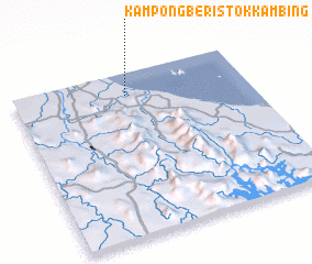 Places with similar names to Kampong Beris Tok Kambing, Malaysia :: Disclaimer :: Information on this page comes without warranty of any kind |
||
|
Where is Kampong Beris Tok Kambing? Elevation and coordinates ::
Latitude (lat): 5°52'0"N Longitude (lon): 102°29'0"E
Elevation (approx.): 9m (map arrows pan, magnifying glasses zoom) |
||
|
Visiting Kampong Beris Tok Kambing? Hotel/Accommodation ::
Book a hotel in Kampong Beris Tok Kambing Travel Guide ::
Buy a travel guide for Malaysia rental cars ::
car rental offers GPS waypoint ::
download a GPX waypoint (PoI) of Kampong Beris Tok Kambing for your GPS receiver
|
||