|
search place name
|
||
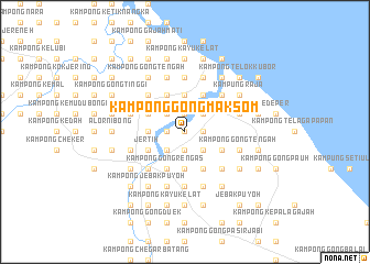
Kampong Gong Mak Som (Terengganu, Malaysia)Kampong Gong Mak Som is a town in the Terengganu region of Malaysia. An overview map of the region around Kampong Gong Mak Som is displayed below.
regional and 3d topo map of Kampong Gong Mak Som, Malaysia ::
Kampong Gong Mak Som airports ::
The nearest airport is KBR - Kota Bahru Sultan Ismail Petra, located 51.6 km north west of Kampong Gong Mak Som.
Other airports nearby include TGG - Kuala Terengganu Sultan Mahmud (76.1 km south east), NAW - Narathiwat (120.8 km north west), KTE - Kerteh (168.2 km south east), PAN - Pattani (189.7 km north west), Nearby towns ::
Alor Lintah (0.0km north) //
Kampong Durian Merkah (0.0km north) //
Kampong Gong Tok Tar (1.8km west) //
Kampong Pintu Gajah (1.9km north) //
Kampong Amir (1.9km north) //
Kampong Lubok Batu (1.9km north) //
Kampong Pasir Merbau (1.9km north) //
Kampong Gong Terap (1.9km south) //
Kampong Baloh (1.9km south) //
Kampong Kubang Bemban (1.8km east) //
Kampong Bukit Puteri (2.6km north west) //
Kampong Nyior Tujoh (2.6km south west) //
Kampong Jawek (2.6km south west) //
Kampong Berhala Tambun (2.6km south west) //
Kampong Gong Kempas (2.6km north east) //
Kampong Gong Pak Ching (2.6km south east) //
Kampong Pekaka (2.6km south east) //
Kampung Tok Raja (3.7km west) //
Kampung Dengir (3.7km west) //
Kampong Gong Surau (3.7km north) //
Kampong Nangka (3.7km north) //
Kampong Bukit Kenak (3.7km south) //
Kampong Pulau Berangan (3.7km south) //
Kampong Gong (3.7km south) //
Kampong Beris Pak Abu (4.1km north west) //
Kampong Baru (4.1km north west) //
Kampong Durian Bongkok (4.1km south west) //
Kampong Pengkalan Setol (4.1km south west) //
Jertih (4.1km south west) //
[all distances 'as the bird flies' and approximate] 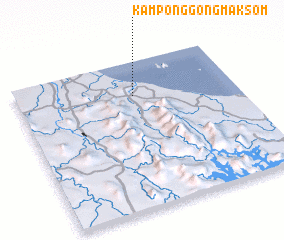 Places with similar names to Kampong Gong Mak Som, Malaysia :: Disclaimer :: Information on this page comes without warranty of any kind |
||
|
Where is Kampong Gong Mak Som? Elevation and coordinates ::
Latitude (lat): 5°46'0"N Longitude (lon): 102°32'0"E
Elevation (approx.): 12m (map arrows pan, magnifying glasses zoom) |
||
|
Visiting Kampong Gong Mak Som? Hotel/Accommodation ::
Book a hotel in Kampong Gong Mak Som Travel Guide ::
Buy a travel guide for Malaysia rental cars ::
car rental offers GPS waypoint ::
download a GPX waypoint (PoI) of Kampong Gong Mak Som for your GPS receiver
|
||