|
search place name
|
||
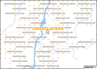
Kampong Jenerih (Kelantan, Malaysia)Kampong Jenerih is a town in the Kelantan region of Malaysia. An overview map of the region around Kampong Jenerih is displayed below.
regional and 3d topo map of Kampong Jenerih, Malaysia ::
Kampong Jenerih airports ::
The nearest airport is KBR - Kota Bahru Sultan Ismail Petra, located 41.9 km north of Kampong Jenerih.
Other airports nearby include NAW - Narathiwat (94.3 km north west), TGG - Kuala Terengganu Sultan Mahmud (110.2 km south east), PAN - Pattani (159.0 km north west), IPH - Ipoh Sultan Azlan Shah (183.4 km south west), Nearby towns ::
Kampong Kubang Katak (1.9km south) //
Kampong Lalang Luas (1.9km north) //
Kampung Kuala Sat (1.8km west) //
Kampong Simpur Belubang (1.8km west) //
Kampong Pak Kundor (1.8km west) //
Kampong Ranggol Petai (1.8km east) //
Kampong Ujit (2.6km south west) //
Kampong Banggol Limau Nipis (2.6km north west) //
Kampong Bukit Belah (3.7km east) //
Kampong Tok Midong (3.7km east) //
Kampong Pak Gombak (3.7km north) //
Kampong Bechah Seladang (3.7km north) //
Kampong Pak Lumat (3.7km north) //
Kampong Machang Gedibing (3.7km north) //
Kampong Kubang Belut (3.7km north) //
Kampong Pasir Sat (3.7km west) //
Kubang Selak (3.7km west) //
Kampong Maka (3.7km west) //
Kampong Lundang (3.7km west) //
Kampong Bunui Tok Mek Teh (4.1km north east) //
Kampong Takil Dalam (4.1km north east) //
Kampong Wek (4.1km north east) //
Kampong Bunut Tok Mak Teh (4.1km north east) //
Kampong Takil Luar (4.1km north east) //
Kampong Batu (4.1km north east) //
Macang (4.1km south east) //
Kampong Pak Majid (4.1km north west) //
Kampong Pulau Raya (4.1km north west) //
Kampong Mata Ayer (4.1km south west) //
[all distances 'as the bird flies' and approximate] 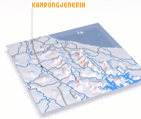 Places with similar names to Kampong Jenerih, Malaysia ::
Disclaimer :: Information on this page comes without warranty of any kind |
||
|
Where is Kampong Jenerih? Elevation and coordinates ::
Latitude (lat): 5°48'0"N Longitude (lon): 102°12'0"E
Elevation (approx.): 30m (map arrows pan, magnifying glasses zoom) |
||
|
Visiting Kampong Jenerih? Hotel/Accommodation ::
Book a hotel in Kampong Jenerih Travel Guide ::
Buy a travel guide for Malaysia rental cars ::
car rental offers GPS waypoint ::
download a GPX waypoint (PoI) of Kampong Jenerih for your GPS receiver
|
||