|
search place name
|
||
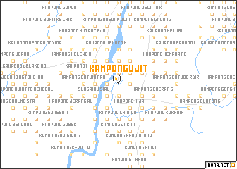
Kampong Ujit (Kelantan, Malaysia)Kampong Ujit is a town in the Kelantan region of Malaysia. An overview map of the region around Kampong Ujit is displayed below.
regional and 3d topo map of Kampong Ujit, Malaysia ::
Kampong Ujit airports ::
The nearest airport is KBR - Kota Bahru Sultan Ismail Petra, located 44.1 km north of Kampong Ujit.
Other airports nearby include NAW - Narathiwat (94.9 km north west), TGG - Kuala Terengganu Sultan Mahmud (111.1 km south east), PAN - Pattani (159.0 km north west), IPH - Ipoh Sultan Azlan Shah (180.8 km south west), Nearby towns ::
Kampong Mata Ayer (1.9km south) //
Kampong Tanah Merah (1.8km west) //
Kampong Bukit (1.8km west) //
Kampong Kabah (1.8km west) //
Kampong Pangkal Berangan (1.8km west) //
Kampong Banggol Nangka (1.8km west) //
Kampong Kelewah (1.8km west) //
Kampung Kuala Sat (1.9km north) //
Kampong Pak Kundor (1.9km north) //
Kampong Simpur Belubang (1.9km north) //
Kampong Kubang Katak (1.8km east) //
Kampong Penegoh (2.6km south west) //
Kampung Paloh (2.6km south west) //
Kampong Maka (2.6km north west) //
Kubang Selak (2.6km north west) //
Kampong Lundang (2.6km north west) //
Kampong Pasir Sat (2.6km north west) //
Kampong Jenerih (2.6km north east) //
Kampong Tanah Merah (3.7km west) //
Kampong Banggol Limau Nipis (3.7km north) //
Sungai Kusial (4.1km south west) //
Kampong Pasir Pinji (4.1km south west) //
Kusial Baharu (4.1km south west) //
Kampong Pangkal Pemanok (4.1km south west) //
Kampong Awah (4.1km south west) //
Kampong Chabir (4.1km north west) //
Tanah Merah (4.1km north west) //
Kampong Rotan Tawar (4.1km north west) //
Kampong Pangkal Kepas (4.1km south east) //
[all distances 'as the bird flies' and approximate] 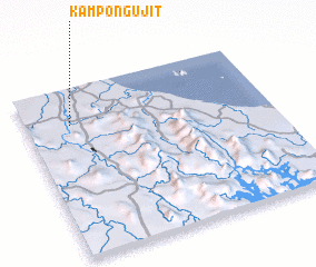 Places with similar names to Kampong Ujit, Malaysia ::
// Kampong Jadeh (MY)
// Kampong Juita (MY)
Disclaimer :: Information on this page comes without warranty of any kind |
||
|
Where is Kampong Ujit? Elevation and coordinates ::
Latitude (lat): 5°47'0"N Longitude (lon): 102°11'0"E
Elevation (approx.): 17m (map arrows pan, magnifying glasses zoom) |
||
|
Visiting Kampong Ujit? Hotel/Accommodation ::
Book a hotel in Kampong Ujit Travel Guide ::
Buy a travel guide for Malaysia rental cars ::
car rental offers GPS waypoint ::
download a GPX waypoint (PoI) of Kampong Ujit for your GPS receiver
|
||