|
search place name
|
||
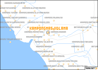
Kampong Masjid Lama (Malaysia)Kampong Masjid Lama is a town in Malaysia. An overview map of the region around Kampong Masjid Lama is displayed below.
regional and 3d topo map of Kampong Masjid Lama, Malaysia ::
Kampong Masjid Lama airports ::
The nearest airport is KUL - Kuala Lumpur Intl, located 82.4 km south east of Kampong Masjid Lama.
Other airports nearby include IPH - Ipoh Sultan Azlan Shah (134.8 km north), MKZ - Malacca (161.5 km south east), DUM - Dumai Pinang Kampai (194.9 km south), KUA - Kuantan (216.9 km east), Nearby towns ::
Kampong Tanjong Siam Baharu (0.0km north) //
Kampong Tanjong Baharu (0.0km north) //
Kampong Kedah (0.0km north) //
Kampong Inche Bahan (0.0km north) //
Kampong Beluntas (1.9km north) //
Kampong Terusan (1.9km north) //
Kampong Sarang Lang (1.9km north) //
Kampong Kuantan (1.9km south) //
Kampong Tanjong Siam (1.9km east) //
Kampong Siak (1.9km east) //
Kampong Pengkalan Ladang (1.9km west) //
Kampong Permatang Durian (2.6km north west) //
Kampong Nyior (2.6km north west) //
Kampong Lubok (2.6km north east) //
Kampong Telok Penyamun (2.6km south west) //
Kampong Asahan (3.7km east) //
Kampong Bukit Belimbing (4.1km north west) //
Kampong Telok Piai (4.1km south west) //
Kampong Puting Belong (5.2km north west) //
Kampong Permatang (5.6km west) //
Kampong Ujong Permatang (5.9km west) //
Pasir Penambang (5.9km west) //
Kampong Pasir Panjang (5.9km west) //
Kuala Selangor (5.9km west) //
Kampong Raja Musa (5.9km north) //
Kampong Baharu (5.9km south) //
Kampong Kuatan (5.9km south) //
Kampung Asam Jawa (7.4km south) //
Kampong Sungai Terap (7.6km west) //
[all distances 'as the bird flies' and approximate] 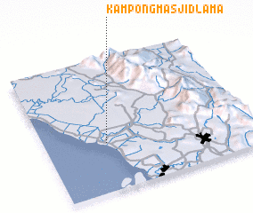 Places with similar names to Kampong Masjid Lama, Malaysia ::
Disclaimer :: Information on this page comes without warranty of any kind |
||
|
Where is Kampong Masjid Lama? Elevation and coordinates ::
Latitude (lat): 3°22'0"N Longitude (lon): 101°18'0"E
Elevation (approx.): 22m (map arrows pan, magnifying glasses zoom) |
||
|
Visiting Kampong Masjid Lama? Hotel/Accommodation ::
Book a hotel in Kampong Masjid Lama Travel Guide ::
Buy a travel guide for Malaysia rental cars ::
car rental offers GPS waypoint ::
download a GPX waypoint (PoI) of Kampong Masjid Lama for your GPS receiver
|
||