|
search place name
|
||
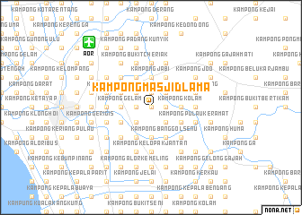
Kampong Masjid Lama (Kedah, Malaysia)Kampong Masjid Lama is a town in the Kedah region of Malaysia. An overview map of the region around Kampong Masjid Lama is displayed below.
regional and 3d topo map of Kampong Masjid Lama, Malaysia ::
Kampong Masjid Lama airports ::
The nearest airport is AOR - Alor Setar Sultan Abdul Halim, located 11.1 km north west of Kampong Masjid Lama.
Other airports nearby include LGK - Pulau Langkawi Intl (85.0 km west), HDY - Songkhla Hat Yai Intl (90.7 km north), PEN - Penang Intl (93.0 km south), PAN - Pattani (106.0 km north east), Nearby towns ::
Kampong Kepala Bukit (0.0km north) //
Kampong Kepala Bendang (1.8km east) //
Kampong Telok Jamat (1.9km north) //
Kampong Bendang Kabu (1.9km north) //
Kampong Saudagar (1.8km west) //
Kampong Hutan Gelam (1.8km west) //
Kampong Keriang Manora (2.6km north east) //
Kampong Tengah (2.6km south east) //
Kampong Tualang (2.6km south east) //
Kampong Alor Rela (2.6km north west) //
Kampong Guar (2.6km north west) //
Kampong Salai Badak (2.6km south west) //
Kampong Kolam (3.7km east) //
Kampong Tanjong Musang Dua (3.7km north) //
Kampong Mekkee (3.7km north) //
Musang Satu (3.7km north) //
Kampong Jabi (3.7km north) //
Kampong Belukar (3.7km north) //
Alor Pak Ngah (3.7km south) //
Kampong Titi Haji Idris (3.7km south) //
Kampong Gelam (3.7km west) //
Kampong Gelam Segompong (3.7km west) //
Kampong Padang Patani (3.7km west) //
Kampong Telaga Dalam (4.1km north east) //
Kampong Lanjut Malau (4.1km north east) //
Kampong Matang Limau (4.1km south east) //
Kampong Tanjong Musang (4.1km north west) //
Kampong Alor China (4.1km south east) //
Kampong Banggol Senu (4.1km south east) //
[all distances 'as the bird flies' and approximate] 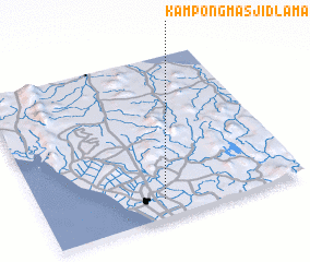 Places with similar names to Kampong Masjid Lama, Malaysia ::
Disclaimer :: Information on this page comes without warranty of any kind |
||
|
Where is Kampong Masjid Lama? Elevation and coordinates ::
Latitude (lat): 6°7'0"N Longitude (lon): 100°28'0"E
Elevation (approx.): 3m (map arrows pan, magnifying glasses zoom) |
||
|
Visiting Kampong Masjid Lama? Hotel/Accommodation ::
Book a hotel in Kampong Masjid Lama Travel Guide ::
Buy a travel guide for Malaysia rental cars ::
car rental offers GPS waypoint ::
download a GPX waypoint (PoI) of Kampong Masjid Lama for your GPS receiver
|
||