|
search place name
|
||
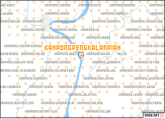
Kampong Pengkalan Piah (Kelantan, Malaysia)Kampong Pengkalan Piah is a town in the Kelantan region of Malaysia. An overview map of the region around Kampong Pengkalan Piah is displayed below.
regional and 3d topo map of Kampong Pengkalan Piah, Malaysia ::
Kampong Pengkalan Piah airports ::
The nearest airport is KBR - Kota Bahru Sultan Ismail Petra, located 23.7 km north of Kampong Pengkalan Piah.
Other airports nearby include NAW - Narathiwat (80.5 km north west), TGG - Kuala Terengganu Sultan Mahmud (117.6 km south east), PAN - Pattani (148.4 km north west), IPH - Ipoh Sultan Azlan Shah (198.6 km south west), Nearby towns ::
Kampong Serendah (0.0km north) //
Kampong Kedondong (0.0km north) //
Kampong Pauh (1.8km east) //
Kampong Padang Tengah (1.8km east) //
Kampong Badak (1.8km east) //
Kampong Kubang Kiat (1.8km east) //
Kampong Kubang Getah (1.8km east) //
Kampong Belukar (1.9km north) //
Kampung Chetok (1.9km north) //
Kampong Tok Kong (1.9km south) //
Kampong Belukar (1.9km south) //
Padang Kubang Chetok (1.8km west) //
Kampong Chetok (1.8km west) //
Kampong Beting Pauh (1.8km west) //
Kampong Kubang Kala (2.6km north east) //
Kampong Talang (2.6km north east) //
Kampong Lubok Papan (2.6km south east) //
Kampong Alor Masam (2.6km south east) //
Kampong Semubar (2.6km north west) //
Kampong Padang Pasir Perah (2.6km south west) //
Ketereh (3.7km east) //
Kampong Binjai (3.7km east) //
Kampong Beta Hulu (3.7km north) //
Kampong Padang Purut (3.7km north) //
Kampong Mas (3.7km north) //
Kampong Setan (3.7km north) //
Kampong Pauh (3.7km south) //
Kampong Pagut (3.7km south) //
Kampong Pangkal Depu (3.7km west) //
[all distances 'as the bird flies' and approximate] 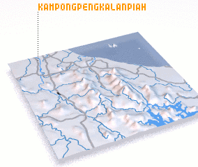 Places with similar names to Kampong Pengkalan Piah, Malaysia ::
// Kampong Pangkalan Empat (MY)
// Kampong Pangkalan Kuap (MY)
// Kampong Pangkal Nering (MY)
// Kampong Pangkal Nering (MY)
// Kampong Pengkalan (MY)
// Kampong Pengkalan (MY)
// Kampong Pengkalan (MY)
// Kampong Pengkalan (MY)
// Kampong Pengkalan (MY)
// Kampong Pengkalan Ajal (MY)
Disclaimer :: Information on this page comes without warranty of any kind |
||
|
Where is Kampong Pengkalan Piah? Elevation and coordinates ::
Latitude (lat): 5°58'0"N Longitude (lon): 102°13'0"E
Elevation (approx.): 20m (map arrows pan, magnifying glasses zoom) |
||
|
Visiting Kampong Pengkalan Piah? Hotel/Accommodation ::
Book a hotel in Kampong Pengkalan Piah Travel Guide ::
Buy a travel guide for Malaysia rental cars ::
car rental offers GPS waypoint ::
download a GPX waypoint (PoI) of Kampong Pengkalan Piah for your GPS receiver
|
||