|
search place name
|
||
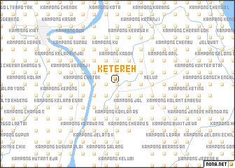
Ketereh (Kelantan, Malaysia)Ketereh is a town in the Kelantan region of Malaysia. An overview map of the region around Ketereh is displayed below.
regional and 3d topo map of Ketereh, Malaysia ::
Ketereh airports ::
The nearest airport is KBR - Kota Bahru Sultan Ismail Petra, located 22.6 km north of Ketereh.
Other airports nearby include NAW - Narathiwat (83.0 km north west), TGG - Kuala Terengganu Sultan Mahmud (114.5 km south east), PAN - Pattani (151.4 km north west), IPH - Ipoh Sultan Azlan Shah (201.0 km south west), Nearby towns ::
Kampong Binjai (0.0km north) //
Kampong But (1.9km north) //
Kampong Gong Puyoh (1.9km north) //
Kampong Kerak (1.9km north) //
Kampong Pengkalan Binjai (1.9km north) //
Kampong Hutan Pasir (1.9km south) //
Kampong Pangkal Kuang (1.9km south) //
Kampong Padang Tengah (1.8km west) //
Kampong Lachang (1.8km east) //
Kampong Kubang Getah (1.8km west) //
Kampong Badak (1.8km west) //
Kampong Tok Mat (1.8km east) //
Kampong Kubang Kiat (1.8km west) //
Kampong Lintah (1.8km east) //
Kampong Pauh (1.8km west) //
Kampong Talang (2.6km north west) //
Kampong Kedondong (2.6km north east) //
Kampong Hangus (2.6km north east) //
Kampong Kubang Kala (2.6km north west) //
Kampong Jenereh (2.6km south east) //
Kampong Alor Masam (2.6km south west) //
Kampong Padang Lembat (2.6km south east) //
Kampong Lubok Papan (2.6km south west) //
Kampong Banggol Lepah (2.6km south east) //
Kampong Kedondong (3.7km west) //
Kampong Pengkalan Piah (3.7km west) //
Kampong Tok Perang (3.7km east) //
Kampong Serendah (3.7km west) //
Kampong Kadok (3.7km north) //
[all distances 'as the bird flies' and approximate] 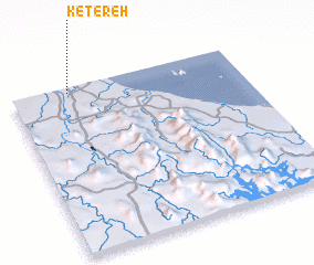 Places with similar names to Ketereh, Malaysia ::
Disclaimer :: Information on this page comes without warranty of any kind |
||
|
Where is Ketereh? Elevation and coordinates ::
Latitude (lat): 5°58'0"N Longitude (lon): 102°15'0"E
Elevation (approx.): 16m (map arrows pan, magnifying glasses zoom) |
||
|
Visiting Ketereh? Hotel/Accommodation ::
Book a hotel in Ketereh Travel Guide ::
Buy a travel guide for Malaysia rental cars ::
car rental offers GPS waypoint ::
download a GPX waypoint (PoI) of Ketereh for your GPS receiver
|
||