|
search place name
|
||
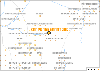
Kampong Semantong (Negeri Sembilan, Malaysia)Kampong Semantong is a town in the Negeri Sembilan region of Malaysia. An overview map of the region around Kampong Semantong is displayed below.
regional and 3d topo map of Kampong Semantong, Malaysia ::
Kampong Semantong airports ::
The nearest airport is KUL - Kuala Lumpur Intl, located 29.9 km south west of Kampong Semantong.
Other airports nearby include MKZ - Malacca (74.7 km south east), DUM - Dumai Pinang Kampai (150.4 km south), KUA - Kuantan (172.3 km north east), IPH - Ipoh Sultan Azlan Shah (210.9 km north west), Nearby towns ::
Kampong Sungai Petai (1.9km south) //
Kampong Sompo (1.9km south) //
Kampong Katup (1.9km south) //
Kampong Sungai Machang Ulu (1.9km west) //
Kampong Jelatok (1.9km east) //
Lengging (1.9km west) //
Kampong Mandum (2.6km south east) //
Kampong Kelusau (2.6km south east) //
Kampong Lenggeng (2.6km south west) //
Kampong Rawa (2.6km south west) //
Kampong Sungai Bunga (2.6km south east) //
Kampong Jelebu (3.7km west) //
Kampong Daching (4.1km north west) //
Kampong Tegor (4.1km north west) //
Kampong Lumbong Jerneh (4.1km north west) //
Kampong Ulu Beranang (4.1km north west) //
Kampong Chelugeh (4.1km north west) //
Kampong Daching Saberang (5.2km north west) //
Kampong Solok (5.2km north west) //
Kampong Sungai Bioh (5.6km west) //
Kampong Sungai Machang Hilir (5.9km west) //
Kampong Sesapan Batu Rembau (6.7km north west) //
Kampong Baharu Mantin (6.7km south west) //
Kampong Bukit Kepong (7.4km west) //
Kampong Kuala Sungai Machang (7.4km west) //
Kampong Sungai Jai (7.4km west) //
Kampong Machang Hilir (7.4km west) //
Kampong Sesapan Batu (7.6km west) //
Kampong Pekan Kechil Beranang (7.6km west) //
[all distances 'as the bird flies' and approximate]  Places with similar names to Kampong Semantong, Malaysia :: Disclaimer :: Information on this page comes without warranty of any kind |
||
|
Where is Kampong Semantong? Elevation and coordinates ::
Latitude (lat): 2°52'0"N Longitude (lon): 101°57'0"E
Elevation (approx.): 83m (map arrows pan, magnifying glasses zoom) |
||
|
Visiting Kampong Semantong? Hotel/Accommodation ::
Book a hotel in Kampong Semantong Travel Guide ::
Buy a travel guide for Malaysia rental cars ::
car rental offers GPS waypoint ::
download a GPX waypoint (PoI) of Kampong Semantong for your GPS receiver
|
||