|
search place name
|
||
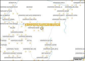
Kampong Sungai Bunga (Negeri Sembilan, Malaysia)Kampong Sungai Bunga is a town in the Negeri Sembilan region of Malaysia. An overview map of the region around Kampong Sungai Bunga is displayed below.
regional and 3d topo map of Kampong Sungai Bunga, Malaysia ::
Kampong Sungai Bunga airports ::
The nearest airport is KUL - Kuala Lumpur Intl, located 30.8 km west of Kampong Sungai Bunga.
Other airports nearby include MKZ - Malacca (72.2 km south east), DUM - Dumai Pinang Kampai (149.5 km south west), KUA - Kuantan (171.9 km north east), IPH - Ipoh Sultan Azlan Shah (213.4 km north west), Nearby towns ::
Kampong Mandum (0.0km north) //
Kampong Kelusau (0.0km north) //
Kampong Jelatok (1.9km north) //
Kampong Sungai Petai (1.9km west) //
Kampong Sompo (1.9km west) //
Kampong Katup (1.9km west) //
Kampong Semantong (2.6km north west) //
Kampong Rawa (3.7km west) //
Kampong Lenggeng (3.7km west) //
Lengging (4.1km north west) //
Kampong Sungai Machang Ulu (4.1km north west) //
Kampong Gayan (5.9km south) //
Kampong Getok (5.9km south) //
Kampong Jelebu (5.9km west) //
Kampong Rambai Baris (6.7km north east) //
Kampung Hulu Kelawang (6.7km north east) //
Kampong Geliu (6.7km north east) //
Kampong Egang (6.7km south east) //
Kampong Tanjong (6.7km south east) //
Kampong Gatoh Telaga (6.7km south east) //
Kampong Daching (6.7km north west) //
Kampong Lumbong Jerneh (6.7km north west) //
Kampong Tegor (6.7km north west) //
Kampong Ulu Beranang (6.7km north west) //
Kampong Chelugeh (6.7km north west) //
Kampong Sungai Machang Hilir (7.4km west) //
Kampong Manggis (7.6km south) //
Kampong Mayor (7.6km south) //
Kampong Baharu Mantin (7.6km west) //
[all distances 'as the bird flies' and approximate]  Places with similar names to Kampong Sungai Bunga, Malaysia ::
// Kampong Sungai Baong (MY)
// Kampung Sungai Bangat (MY)
Disclaimer :: Information on this page comes without warranty of any kind |
||
|
Where is Kampong Sungai Bunga? Elevation and coordinates ::
Latitude (lat): 2°51'0"N Longitude (lon): 101°58'0"E
Elevation (approx.): 100m (map arrows pan, magnifying glasses zoom) |
||
|
Visiting Kampong Sungai Bunga? Hotel/Accommodation ::
Book a hotel in Kampong Sungai Bunga Travel Guide ::
Buy a travel guide for Malaysia rental cars ::
car rental offers GPS waypoint ::
download a GPX waypoint (PoI) of Kampong Sungai Bunga for your GPS receiver
|
||