|
search place name
|
||
Kampong Sungai Batu Larangan (Kedah, Malaysia)Kampong Sungai Batu Larangan is a town in the Kedah region of Malaysia. An overview map of the region around Kampong Sungai Batu Larangan is displayed below.
regional and 3d topo map of Kampong Sungai Batu Larangan, Malaysia ::

Kampong Sungai Batu Larangan airports ::
The nearest airport is PEN - Penang Intl, located 42.7 km south west of Kampong Sungai Batu Larangan.
Other airports nearby include AOR - Alor Setar Sultan Abdul Halim (59.8 km north), LGK - Pulau Langkawi Intl (108.3 km north west), IPH - Ipoh Sultan Azlan Shah (140.2 km south east), HDY - Songkhla Hat Yai Intl (142.0 km north), Nearby towns ::
Kampong Sungai Gelam (1.9km north) //
Kampong Sungai Keluang (1.9km north) //
Kampong Telok Ayer (2.6km south west) //
Kampong Pengkalan Bukit Kechik (2.6km south west) //
Kampong Segantang Garam (2.6km north west) //
Kampong Pengkalan Bujang (3.7km north) //
Kampong Bujang (3.7km north) //
Kampong Langgar (3.7km north) //
Kampong Telok Wang Kechil (3.7km south) //
Kampong Permatang Perlis (4.1km north west) //
Kampong Permatang Binjai (4.1km north west) //
Kampong Sungai Baru (4.1km north west) //
Kampong Perlis Bukit Kechik (4.1km south west) //
Kampong Pengkalan Batu Lintang (4.1km south west) //
Kampong Misjid (4.1km south east) //
Kampong Telok Wang (4.1km south east) //
Kampong Komol (5.2km south west) //
Kampong Batu Lintang (5.2km south west) //
Kampong Permatang Batu Lintang (5.2km south west) //
Kampong Padang (5.2km south east) //
Kampong Charok Klubi (5.2km south east) //
Kampong Sungai Pasir (5.2km south east) //
Kampong Sungai Layar (5.5km east) //
Kampong Telok (5.5km east) //
Kampong Alor Bemban (5.6km north) //
Kampong Bendang Dalam (5.9km north) //
Kampong Batu Hampar (5.9km north) //
Kampong Tempoyak (5.9km north) //
Kampong Pondok (5.9km north) //
[all distances 'as the bird flies' and approximate] 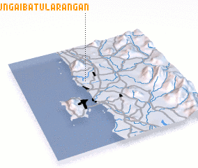 Places with similar names to Kampong Sungai Batu Larangan, Malaysia ::
Disclaimer :: Information on this page comes without warranty of any kind |
||
|
Where is Kampong Sungai Batu Larangan? Elevation and coordinates ::
Latitude (lat): 5°39'0"N Longitude (lon): 100°26'0"E
Elevation (approx.): 18m (map arrows pan, magnifying glasses zoom) |
||
|
Visiting Kampong Sungai Batu Larangan? Hotel/Accommodation ::
Book a hotel in Kampong Sungai Batu Larangan Travel Guide ::
Buy a travel guide for Malaysia rental cars ::
car rental offers GPS waypoint ::
download a GPX waypoint (PoI) of Kampong Sungai Batu Larangan for your GPS receiver
|
||