|
search place name
|
||
Kampong Sungai Layar (Kedah, Malaysia)Kampong Sungai Layar is a town in the Kedah region of Malaysia. An overview map of the region around Kampong Sungai Layar is displayed below.
regional and 3d topo map of Kampong Sungai Layar, Malaysia ::

Kampong Sungai Layar airports ::
The nearest airport is PEN - Penang Intl, located 45.2 km south west of Kampong Sungai Layar.
Other airports nearby include AOR - Alor Setar Sultan Abdul Halim (60.4 km north), LGK - Pulau Langkawi Intl (112.4 km north west), IPH - Ipoh Sultan Azlan Shah (137.4 km south east), HDY - Songkhla Hat Yai Intl (142.3 km north), Nearby towns ::
Kampong Telok (0.0km north) //
Kampong Baru (1.9km south) //
Sungai Petani (1.8km east) //
Kampong Tongka (1.8km east) //
Kampong Raja (2.6km south east) //
Kampong Jalan Kerbau (2.6km south east) //
Kampong Sungai Limau (3.7km north) //
Kampong Charok Klubi (4.1km south west) //
Kampong Padang (4.1km south west) //
Kampong Sungai Pasir (4.1km south west) //
Kampong Misjid (5.2km south west) //
Kampong Telok Wang (5.2km south west) //
Kampong Sungai Batu Larangan (5.5km west) //
Kampong Matang Tok Gedong (5.6km south) //
Semiling (5.9km north) //
Kampong Padang Temensu (5.9km south) //
Kampong Sungai Pasir Kechil (5.8km east) //
Kampong Sungai Keluang (5.8km west) //
Kampong Sungai Gelam (5.8km west) //
Kampong Pinang (5.9km north) //
Kampong Langgar (6.7km north west) //
Kampong Bujang (6.7km north west) //
Kampong Pengkalan Bujang (6.7km north west) //
Kampong Telok Wang Kechil (6.7km south west) //
Sungai Lalang (6.7km north east) //
Kampong Serukam (6.7km south east) //
Kampong Matang Berangah (7.4km south) //
Kampong Telok Ayer (7.6km west) //
Kampong Pengkalan Bukit Kechik (7.6km west) //
[all distances 'as the bird flies' and approximate] 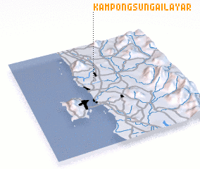 Places with similar names to Kampong Sungai Layar, Malaysia :: Disclaimer :: Information on this page comes without warranty of any kind |
||
|
Where is Kampong Sungai Layar? Elevation and coordinates ::
Latitude (lat): 5°39'0"N Longitude (lon): 100°29'0"E
Elevation (approx.): 20m (map arrows pan, magnifying glasses zoom) |
||
|
Visiting Kampong Sungai Layar? Hotel/Accommodation ::
Book a hotel in Kampong Sungai Layar Travel Guide ::
Buy a travel guide for Malaysia rental cars ::
car rental offers GPS waypoint ::
download a GPX waypoint (PoI) of Kampong Sungai Layar for your GPS receiver
|
||