|
search place name
|
||
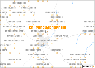
Kampong Ujong Pasir (Negeri Sembilan, Malaysia)Kampong Ujong Pasir is a town in the Negeri Sembilan region of Malaysia. An overview map of the region around Kampong Ujong Pasir is displayed below.
regional and 3d topo map of Kampong Ujong Pasir, Malaysia ::
Kampong Ujong Pasir airports ::
The nearest airport is KUL - Kuala Lumpur Intl, located 28.6 km west of Kampong Ujong Pasir.
Other airports nearby include MKZ - Malacca (60.9 km south east), DUM - Dumai Pinang Kampai (137.7 km south west), KUA - Kuantan (179.8 km north east), JHB - Johor Bahru Sultan Ismail (224.6 km south east), Nearby towns ::
Kampung Gedung Lalang (0.0km north) //
Kampong Baharu Gedang Lalang (0.0km north) //
Kampong Jiboi (0.0km north) //
Ampangan (1.9km south) //
Kampong Dusun Nyiur (1.9km south) //
Rahang Besar (1.9km south) //
Sikamat New Village (1.9km north) //
Kampong Baharu Bukit Temiang (1.9km west) //
Kampong Merbah (1.9km west) //
Batu Empat (2.6km north east) //
Kampong Baharu Rahang (3.7km south) //
Kampong Lobok (3.7km west) //
Kampong Baharu Paroi (4.1km south east) //
Senawang (4.1km south east) //
Kampong Abok (4.1km south west) //
Rahang Kechil (4.1km south west) //
Kampong Sikamat (4.1km north east) //
Seremban (4.1km south west) //
Kampong Jerlang (5.2km north east) //
Kampong Bukit Kubot (5.2km north east) //
Kampong Ulu Mantau (5.2km south west) //
Rasah (5.2km south west) //
Rasah New Village (5.2km south west) //
Kampong Paroi (5.9km east) //
Kampong Mayor (5.9km north) //
Kampong Manggis (5.9km north) //
Kampong Bemban (6.7km north east) //
Kampong Petai (6.7km north east) //
Kampong Denai (6.7km north east) //
[all distances 'as the bird flies' and approximate] 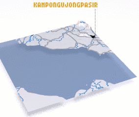 Places with similar names to Kampong Ujong Pasir, Malaysia :: Disclaimer :: Information on this page comes without warranty of any kind |
||
|
Where is Kampong Ujong Pasir? Elevation and coordinates ::
Latitude (lat): 2°44'0"N Longitude (lon): 101°58'0"E
Elevation (approx.): 56m (map arrows pan, magnifying glasses zoom) |
||
|
Visiting Kampong Ujong Pasir? Hotel/Accommodation ::
Book a hotel in Kampong Ujong Pasir Travel Guide ::
Buy a travel guide for Malaysia rental cars ::
car rental offers GPS waypoint ::
download a GPX waypoint (PoI) of Kampong Ujong Pasir for your GPS receiver
|
||