|
search place name
|
||
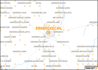
Rahang Kechil (Negeri Sembilan, Malaysia)Rahang Kechil is a town in the Negeri Sembilan region of Malaysia. An overview map of the region around Rahang Kechil is displayed below.
regional and 3d topo map of Rahang Kechil, Malaysia ::
Rahang Kechil airports ::
The nearest airport is KUL - Kuala Lumpur Intl, located 27.2 km west of Rahang Kechil.
Other airports nearby include MKZ - Malacca (58.8 km south east), DUM - Dumai Pinang Kampai (133.6 km south west), KUA - Kuantan (183.6 km north east), JHB - Johor Bahru Sultan Ismail (224.3 km south east), Nearby towns ::
Kampong Abok (0.0km north) //
Rasah (1.9km west) //
Kampong Baharu Rahang (1.9km east) //
Rasah New Village (1.9km west) //
Kampong Ulu Mantau (1.9km west) //
Rahang Besar (2.6km north east) //
Seremban (2.6km north west) //
Kampong Mantau (2.6km south west) //
Kampong Dusun Nyiur (2.6km north east) //
Ampangan (2.6km north east) //
Senawang (3.7km east) //
Kampong Baharu Bukit Temiang (3.7km north) //
Kampong Merbah (3.7km north) //
Kampung Gedung Lalang (4.1km north east) //
Kampong Lobok (4.1km north west) //
Kampong Jiboi (4.1km north east) //
Kampong Ujong Pasir (4.1km north east) //
Kampong Baharu Gedang Lalang (4.1km north east) //
Kampong Latak (4.1km south west) //
Kampung Baharu Mambau (5.2km south west) //
Kampong Mambau (5.2km south west) //
Kampong Kayu Ara (5.2km south west) //
Kampong Belangkan (5.6km south) //
Kampong Ulu Belangkan (5.6km south) //
Kampong Nyatoh (5.6km south) //
Kampong Baharu Paroi (5.9km east) //
Sikamat New Village (5.9km north) //
Kampong Bemban Hilir (5.9km south) //
Batu Empat (6.7km north east) //
[all distances 'as the bird flies' and approximate] 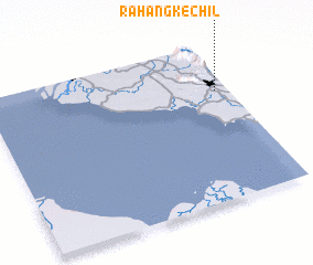 Places with similar names to Rahang Kechil, Malaysia :: Disclaimer :: Information on this page comes without warranty of any kind |
||
|
Where is Rahang Kechil? Elevation and coordinates ::
Latitude (lat): 2°42'0"N Longitude (lon): 101°57'0"E
Elevation (approx.): 49m (map arrows pan, magnifying glasses zoom) |
||
|
Visiting Rahang Kechil? Hotel/Accommodation ::
Book a hotel in Rahang Kechil Travel Guide ::
Buy a travel guide for Malaysia rental cars ::
car rental offers GPS waypoint ::
download a GPX waypoint (PoI) of Rahang Kechil for your GPS receiver
|
||