|
search place name
|
||
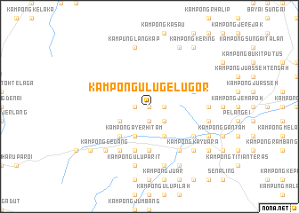
Kampong Ulu Gelugor (Negeri Sembilan, Malaysia)Kampong Ulu Gelugor is a town in the Negeri Sembilan region of Malaysia. An overview map of the region around Kampong Ulu Gelugor is displayed below.
regional and 3d topo map of Kampong Ulu Gelugor, Malaysia ::
Kampong Ulu Gelugor airports ::
The nearest airport is KUL - Kuala Lumpur Intl, located 51.0 km west of Kampong Ulu Gelugor.
Other airports nearby include MKZ - Malacca (58.3 km south), DUM - Dumai Pinang Kampai (153.3 km south west), KUA - Kuantan (159.5 km north east), JHB - Johor Bahru Sultan Ismail (209.5 km south east), Nearby towns ::
Kampong Geyet (0.0km north) //
Kampong Gayet (0.0km north) //
Kampong Baning (1.9km south) //
Kampong Kok (1.9km east) //
Kampong Jeram (1.9km west) //
Kampong Purgong (2.6km south east) //
Kampong Telang (2.6km south east) //
Kampong Rumali (4.1km south east) //
Kampong Ayer Hitam (4.1km south west) //
Kampong Mempas Kechil (4.1km south west) //
Kampong Bukit Melintang (4.1km south west) //
Kampong Durian Hijau (4.1km south west) //
Kampong Belayat (4.1km south west) //
Kampong Ulu Mempas (5.2km south west) //
Kampong Pauh (5.2km south west) //
Kampong Kundangan (5.2km south west) //
Kampong Ibol (5.6km south) //
Kampong Tebing Tinggi (5.6km south) //
Kampong Parit (5.9km south) //
Kampong Mempas Besar (5.9km south) //
Kampong Parit Tengah (5.9km south) //
Kampong Kuala Parit (5.9km south) //
Kampung Baharu Parit Tinggi (5.9km east) //
Kampong Tanjong Ipoh (6.7km south east) //
Kampong Parit Muar (6.7km south east) //
Kampong Parit Kechil (6.7km south east) //
Ayer Sejok (6.7km south west) //
Kampong Padang Lebar (6.7km south west) //
Ulu Bendol New Village (6.7km south west) //
[all distances 'as the bird flies' and approximate] 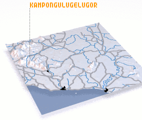 Places with similar names to Kampong Ulu Gelugor, Malaysia :: Disclaimer :: Information on this page comes without warranty of any kind |
||
|
Where is Kampong Ulu Gelugor? Elevation and coordinates ::
Latitude (lat): 2°47'0"N Longitude (lon): 102°10'0"E
Elevation (approx.): 145m (map arrows pan, magnifying glasses zoom) |
||
|
Visiting Kampong Ulu Gelugor? Hotel/Accommodation ::
Book a hotel in Kampong Ulu Gelugor Travel Guide ::
Buy a travel guide for Malaysia rental cars ::
car rental offers GPS waypoint ::
download a GPX waypoint (PoI) of Kampong Ulu Gelugor for your GPS receiver
|
||