|
search place name
|
||
Kampung Gial (Perlis, Malaysia)Kampung Gial is a town in the Perlis region of Malaysia. An overview map of the region around Kampung Gial is displayed below.
regional and 3d topo map of Kampung Gial, Malaysia ::

Kampung Gial airports ::
The nearest airport is AOR - Alor Setar Sultan Abdul Halim, located 33.2 km south of Kampung Gial.
Other airports nearby include HDY - Songkhla Hat Yai Intl (53.0 km north), LGK - Pulau Langkawi Intl (63.2 km west), PAN - Pattani (102.5 km east), PEN - Penang Intl (129.3 km south), Nearby towns ::
Kampong Tendut (0.0km north) //
Kampung Banggul Sena (0.0km north) //
Kampong Kerisek (1.8km west) //
Kampong Baiek Guar (1.9km north) //
Kampung Peret (1.9km north) //
Kampung Kuala Tunggang (1.9km south) //
Kampung Padang Laut (1.8km east) //
Balek Bukit (2.6km north west) //
Kampung Kuan Pelik (2.6km south west) //
Kampung Hutan Palas (2.6km south west) //
Kampung Guar Gajah (2.6km south west) //
Kampung Kok Kelang (2.6km north east) //
Kampung Kubang Perun (2.6km north east) //
Pauh (2.6km south east) //
Kampung Padang Siding (2.6km south east) //
Kampung Oran (3.7km west) //
Kampung Mata Ayer (3.7km west) //
Hutan Buloh (3.7km west) //
Kampung Jelutong (3.7km north) //
Kampong Gur Guring (3.7km south) //
Kampung Belukar (3.7km south) //
Kampung Kebun (3.7km south) //
Kampung Guring (3.7km south) //
Kampung Paya (3.7km south) //
Kampung Rambai (3.7km east) //
Kampong Mata Ayer (4.1km north west) //
Kampung Chuping Balek Bukit (4.1km north west) //
Kampung Keriang Dan (4.1km south west) //
Kampung Kubang Gajah (4.1km south west) //
[all distances 'as the bird flies' and approximate] 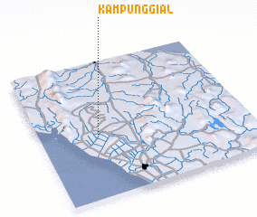 Places with similar names to Kampung Gial, Malaysia ::
// Kampong Loh (MY)
// Kampong Ulau (MY)
// Kampong Ulu (MY)
// Kampong Ulu (MY)
// Kampong Ulu (MY)
// Kampong Ulu (MY)
// Kampong Ulu (MY)
// Kampong Ulu (MY)
// Kampung Gula (MY)
// Kampung La (MY)
Disclaimer :: Information on this page comes without warranty of any kind |
||
|
Where is Kampung Gial? Elevation and coordinates ::
Latitude (lat): 6°28'0"N Longitude (lon): 100°17'0"E
Elevation (approx.): 18m (map arrows pan, magnifying glasses zoom) |
||
|
Visiting Kampung Gial? Hotel/Accommodation ::
Book a hotel in Kampung Gial Travel Guide ::
Buy a travel guide for Malaysia rental cars ::
car rental offers GPS waypoint ::
download a GPX waypoint (PoI) of Kampung Gial for your GPS receiver
|
||