|
search place name
|
||
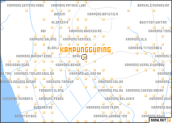
Kampung Guring (Perlis, Malaysia)Kampung Guring is a town in the Perlis region of Malaysia. An overview map of the region around Kampung Guring is displayed below.
regional and 3d topo map of Kampung Guring, Malaysia ::
Kampung Guring airports ::
The nearest airport is AOR - Alor Setar Sultan Abdul Halim, located 29.8 km south east of Kampung Guring.
Other airports nearby include HDY - Songkhla Hat Yai Intl (56.6 km north), LGK - Pulau Langkawi Intl (62.4 km west), PAN - Pattani (103.8 km east), PEN - Penang Intl (125.6 km south), Nearby towns ::
Kampong Gur Guring (0.0km north) //
Kampung Paya (0.0km north) //
Kampung Belukar (0.0km north) //
Kampung Kebun (0.0km north) //
Kampong Bakong (1.8km west) //
Arau (1.8km west) //
Kampung Bakang (1.8km west) //
Kampong Beluka Halbah (1.9km south) //
Kampong Hutan Kandis (1.9km south) //
Kampung Guar Sanji (1.9km south) //
Kampung Kuala Tunggang (1.9km north) //
Kampung Guar Paya (1.8km east) //
Kampung Kubang (1.8km east) //
Kampung Padang Telela (1.8km east) //
Kampung Banat Syed Harun (2.6km south west) //
Kampung Banat Bawah (2.6km south west) //
Kampung Hutan Palas (2.6km north west) //
Kampung Kuan Pelik (2.6km north west) //
Kampung Guar Gajah (2.6km north west) //
Kampung Hutan Chelong (2.6km south east) //
Kampung Guar Ipoh (2.6km south east) //
Kampung Ulu (2.6km south east) //
Kampung Kubang Paya (2.6km south east) //
Pauh (2.6km north east) //
Kampung Padang Siding (2.6km north east) //
Kampung Behor Pisang (3.7km west) //
Kampong Jelempah (3.7km south) //
Kampung Cheremai (3.7km south) //
Kampung Gial (3.7km north) //
[all distances 'as the bird flies' and approximate] 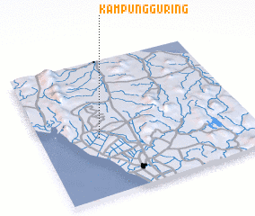 Places with similar names to Kampung Guring, Malaysia ::
// Kampong Rangoi (MY)
// Kampong Runguh (MY)
// Kampung Renek (MY)
// Kampong Ranggu (BN)
// Kampong Riong (BN)
// Kampong Riong (BN)
// Kampong Gerong (MY)
// Kampong Gerong (MY)
// Kampong Giring (MY)
Disclaimer :: Information on this page comes without warranty of any kind |
||
|
Where is Kampung Guring? Elevation and coordinates ::
Latitude (lat): 6°26'0"N Longitude (lon): 100°17'0"E
Elevation (approx.): 10m (map arrows pan, magnifying glasses zoom) |
||
|
Visiting Kampung Guring? Hotel/Accommodation ::
Book a hotel in Kampung Guring Travel Guide ::
Buy a travel guide for Malaysia rental cars ::
car rental offers GPS waypoint ::
download a GPX waypoint (PoI) of Kampung Guring for your GPS receiver
|
||