|
search place name
|
||
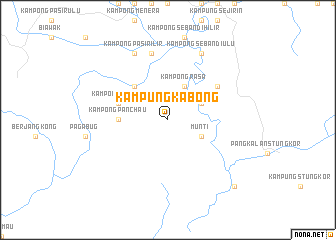
Kampung Kabong (Sarawak, Malaysia)Kampung Kabong is a town in the Sarawak region of Malaysia. An overview map of the region around Kampung Kabong is displayed below.
regional and 3d topo map of Kampung Kabong, Malaysia ::
Kampung Kabong airports ::
The nearest airport is KCH - Kuching Intl, located 59.3 km east of Kampung Kabong.
Other airports nearby include PNK - Pontianak Supadio (191.8 km south), SQC - Sintang Susilo (245.8 km south east), Nearby towns ::
Kampong Munti (4.1km south east) //
Munti (4.1km south east) //
Kampong Selampit (4.1km north east) //
Kampong Rasa (4.1km north east) //
Kampung Bukit Batu (5.2km north west) //
Kampong Panchau (5.6km west) //
Kampong Pegong (5.9km west) //
Kampong Kandai (5.9km west) //
Kampong Perian (6.7km north east) //
Kampong Pasir Ilir (7.6km north) //
Kampong Sebandi Ulu (8.3km north east) //
Kampong Pasir Ilir (8.3km north west) //
Kampong Lubok Mengeris (8.3km north west) //
Kampung Rasau Lalang (10.5km south east) //
[all distances 'as the bird flies' and approximate] 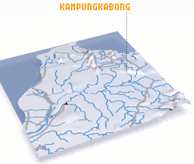 Places with similar names to Kampung Kabong, Malaysia ::
// Kampong Kubang (MY)
// Kampong Kubang (MY)
// Kampong Kubong (MY)
// Kampong Kubong (MY)
// Kampung Cabang (MY)
// Kampung Kabang (MY)
// Kampung Kubang (MY)
// Kampong Kubong (TH)
// Kampong Kobong (BN)
// Kampong Kabong (MY)
Disclaimer :: Information on this page comes without warranty of any kind |
||
|
Where is Kampung Kabong? Elevation and coordinates ::
Latitude (lat): 1°32'0"N Longitude (lon): 109°49'0"E
Elevation (approx.): 8m (map arrows pan, magnifying glasses zoom) |
||
|
Visiting Kampung Kabong? Hotel/Accommodation ::
Book a hotel in Kampung Kabong Travel Guide ::
Buy a travel guide for Malaysia rental cars ::
car rental offers GPS waypoint ::
download a GPX waypoint (PoI) of Kampung Kabong for your GPS receiver
|
||