|
search place name
|
||
Kampong Kubong (Narathiwat, Thailand)Kampong Kubong is a town in the Narathiwat region of Thailand. An overview map of the region around Kampong Kubong is displayed below.
regional and 3d topo map of Kampong Kubong, Thailand ::

Kampong Kubong airports ::
The nearest airport is KBR - Kota Bahru Sultan Ismail Petra, located 49.7 km north east of Kampong Kubong.
Other airports nearby include NAW - Narathiwat (65.4 km north), PAN - Pattani (123.9 km north west), TGG - Kuala Terengganu Sultan Mahmud (147.3 km south east), AOR - Alor Setar Sultan Abdul Halim (168.3 km west), Nearby towns ::
Ban To Lang (0.0km north) //
Kampong Tolae (1.9km north) //
Waeng (1.9km south) //
Kampong To Lang (1.9km south) //
Amphoe Sungai Kolok (1.8km west) //
To Mo (2.6km south east) //
Ban Hita (3.7km east) //
Kampong Bakok (4.1km south east) //
Kampong Limau Purut (5.2km south east) //
Ban Tu Lae (5.2km north east) //
Ban Sakhu (5.2km north west) //
Kampong Padang Bukit (5.5km east) //
Kampong Gual Tok Limah (5.5km east) //
Kampong Kubang Bakong (5.8km east) //
Kampong Lubok Setol (5.8km east) //
Kampong Pengkalan Machang (5.8km east) //
Kampong Tanjong Erat (5.8km east) //
Kampong Kok Ka (6.7km south east) //
Kampong Degong (6.7km north east) //
Kampong Bendang Sega (6.7km north east) //
Kampong Sako (6.7km north west) //
Kampong Telaga Mas (7.6km east) //
Ban Nali (7.6km west) //
Kampong Bukit Kuang (7.6km east) //
Kampong Gual Tualang (7.6km east) //
Kampong Tanyong Kamae (7.6km north) //
Kampong Ka Kheng (8.3km north east) //
Kampong Padang Nyior (8.3km north east) //
Kampong Kok Pauh (8.3km north east) //
[all distances 'as the bird flies' and approximate] 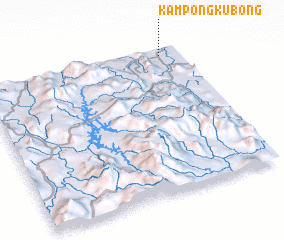 Places with similar names to Kampong Kubong, Thailand ::
// Kampong Kubang (MY)
// Kampong Kubang (MY)
// Kampong Kubong (MY)
// Kampong Kubong (MY)
// Kampung Cabang (MY)
// Kampung Kabang (MY)
// Kampung Kabong (MY)
// Kampung Kubang (MY)
// Kampong Kobong (BN)
// Kampong Kabong (MY)
Disclaimer :: Information on this page comes without warranty of any kind |
||
|
Where is Kampong Kubong? Elevation and coordinates ::
Latitude (lat): 5°57'0"N Longitude (lon): 101°54'0"E
Elevation (approx.): 34m (map arrows pan, magnifying glasses zoom) |
||
|
Visiting Kampong Kubong? Hotel/Accommodation ::
Book a hotel in Kampong Kubong Travel Guide ::
Buy a travel guide for Thailand rental cars ::
car rental offers GPS waypoint ::
download a GPX waypoint (PoI) of Kampong Kubong for your GPS receiver
|
||