|
search place name
|
||
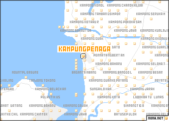
Kampung Penaga (Pulau Pinang, Malaysia)Kampung Penaga is a town in the Pulau Pinang region of Malaysia. An overview map of the region around Kampung Penaga is displayed below.
regional and 3d topo map of Kampung Penaga, Malaysia ::
Kampung Penaga airports ::
The nearest airport is PEN - Penang Intl, located 27.0 km south west of Kampung Penaga.
Other airports nearby include AOR - Alor Setar Sultan Abdul Halim (74.4 km north), LGK - Pulau Langkawi Intl (115.5 km north west), IPH - Ipoh Sultan Azlan Shah (131.1 km south east), HDY - Songkhla Hat Yai Intl (156.7 km north), Nearby towns ::
Permatang Berah (0.0km north) //
Permatang Pa' Maras (0.0km north) //
Lahar Tabot (0.0km north) //
Permatang Kuala (0.0km north) //
Kampong Permatang Rambai (0.0km north) //
Lahar Endin (1.9km north) //
Kampong Padang Tembesu (1.9km north) //
Bakar Kapor (1.9km north) //
Kampong Bekah (1.8km west) //
Bagan Belat (1.9km south) //
Kampong Permatang Pauh (1.8km east) //
Pokok Nangka (1.8km east) //
Kampong Permatang Sintok (1.8km east) //
Kampung Sungai Tembus (1.9km west) //
Penaga (2.2km south west) //
Permatang Kuang Besar (2.6km north east) //
Permatang Kuang Kechil (2.6km north east) //
Permatang Kuang (2.6km north east) //
Paya Temusu (2.6km north east) //
Padang Benggali (2.6km south west) //
Selarong Gajah (2.6km south east) //
Kampong Permatang Pak Elong (2.6km south east) //
Permatang Binjai (2.6km south east) //
Permatang Tok Gelam (2.6km south east) //
Kampong Sungai Tembus (3.7km north) //
Kampong Tok Labu (3.7km north) //
Permatang Manggis (3.7km east) //
Bagan Tambang (3.7km south) //
Telok Ayer Tawar (3.7km south) //
[all distances 'as the bird flies' and approximate] 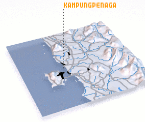 Places with similar names to Kampung Penaga, Malaysia ::
// Kampong Pang (MY)
// Kampong Penaga (MY)
// Kampong Penaga (MY)
// Kampong Penaga (MY)
// Kampong Penaga (MY)
// Kampong Penagu (MY)
// Kampong Penak (MY)
// Kampong Penegoh (MY)
// Kampong Pengau (MY)
// Kampong Piangu (MY)
Disclaimer :: Information on this page comes without warranty of any kind |
||
|
Where is Kampung Penaga? Elevation and coordinates ::
Latitude (lat): 5°31'0"N Longitude (lon): 100°23'0"E
Elevation (approx.): 7m (map arrows pan, magnifying glasses zoom) |
||
|
Visiting Kampung Penaga? Hotel/Accommodation ::
Book a hotel in Kampung Penaga Travel Guide ::
Buy a travel guide for Malaysia rental cars ::
car rental offers GPS waypoint ::
download a GPX waypoint (PoI) of Kampung Penaga for your GPS receiver
|
||